

“Growth is not a certainty like death and taxes but in James City, it is not likely to be a passing fad, either.”
Jack Edwards, Chairman James City County Board of Supervisors 1985
James City County is on a precipice; that a continuation of past zoning and land use policies will bring about a fiscal, economic and environmental crisis long before 2045
Executive Summary
As James City County embarks upon another revision of its Comprehensive Plan – Engage 2045 – the Hampton Roads Transportation Planning Organization Traffic Analysis Zone (TAZ) model projects that county population will increase by 60% from today’s 76,000 to 120,741 in 2045. This places the county on a precipice, facing a fiscal, economic and environmental crisis long before 2045 unless zoning and land use policies are changed significantly.
For the first time, this revision process will include likely growth scenarios for the county in the next thirty years by utilizing the Hampton Roads Transportation Planning Organizations Model and its three components – the Traffic Demand Model, a Land Use Model, and the Transportation Economic Model, TREDIS.
Five of the Citizen Survey questions show a significant gap between the following issues that citizens deem important and with which they are not satisfied. All are interwoven with population growth. While this paper will address two of those issues – preserving the rural character and protecting the environment – all five of these gap areas should be considered as we evaluate the efficacy of the three growth scenarios.
- Affordable housing – 33% gap (83% important vs. 50% satisfied)
- Roads & highways – 24% gap (98% important vs. 74% satisfied)
- Attracting jobs& businesses – 20% gap (88% important vs. 68% satisfied)
- Preserving rural character – 16% gap (85% important vs. 69% satisfied)
- Protecting environment – 15% gap (85% important vs. 70% satisfied)
If citizens are not satisfied now, they will be less so if no changes are made to the county’s land-use policies.
The TAZs data projects 2045 population, households, and vehicle trips which overlay at the sub-watershed level. These, along with new buildings, homes, roads, driveways, and parking lots, allow us to project future increases in impervious cover and to assess the cumulative impact on the county’s environment and rural character. To date that impact has not been cheap: the county has spent about $9.4M from 2008- 2015 and plans to spend another $21.3M over the next five years. Without a significant change in the county’s growth policies, these costs are certain to grow. This paper will examine the current and future land usage for economic development and the impact that usage had and will have on the county’s environment and rural character.
TAZ projections show a very high population and impervious surface growth in the Yarmouth Creek, Skimino, Ware Creek, and the Diascund Creek watershed driven by the buildout of the Barhmasville 227 Interchange and the Toano- Anderson Corner Economic Opportunity Areas, among other areas.
The Skimino Creek and Yarmouth watersheds will also be subject to rapid population growth if the Hill Pleasant Farm/Mooretown Road Economic Opportunity Area is buildout. Immediately to the east, York County’s portion of Lightfoot is also undergoing a rapid transition from farmland to apartments, single-family residential, and commercial. The impacts on both Skimino and Yarmouth watersheds from increased impervious cover with the corresponding loss of forest and agricultural lands coupled with the current and future traffic congestion from economic and residential development by both James City and York County in the same area requires a re-examination of why the Mooretown Road/Hill Pleasant Farm Area is designated as an economic opportunity area in the Engage 2045 Comprehensive Plan.
There are opportunities that the watershed paper discuss and there are set of consistent themes throughout each of the watershed papers –
- Conservation and preservation programs protect the ecosystem services that our watershed provides for wildlife and plant habitat.
- Each section talks about the PDR, AFD, and other conservation programs’ contributions and their cost to conserve and protect the environment and rural character. Between 1997 and 2016 the county spent $30.1M on 27 PDR and Green-space projects placing 2,035 acres in a conservation easement of one type or another. ( Mill AFD/PDR, Powhatan AFD/PDR, Yarmouth AFD/PDR, Gordon AFD/PDR, Skimino AFD/PDR, Ware AFD/PDR )
- There are significant areas of the Gordon, Yarmouth and Ware Creek that are rated as outstanding and very high for their environmental and ecologically habitat by the Commonwealth.
- There is a section on Ecotourism as an economic opportunity for the Lower Chickahominy. It says “in James City County for every $1.00 spent annually in the provision of public services to support land with conservation easements, revenues to James City County were estimated to be $1.53.”
- There is a look at the three economic opportunity areas form the 2035 Comp Plan and suggests a land-use change for the Mooretown/Hi Pleasant Farm EO areas. There is a caution and need for balance as the Barhamsville Interchange and the Toano/Anderson’s Corner EO Areas are developed with a review of current zoning and land-use policies surrounding these EO areas.
- Sea-level rise will alter the future freshwater tidal ecosystem of the six watersheds. There is an inland migration of their marshlands, changes to resource protections areas, and increased salinity levels. Mill Creek, Powhatan Creek, Yarmouth Creek, Gordon Creek, Skimino Creek, and Ware Creek.
- The combination of sea-level rise and the increasing amount of rainfall may increase incidents of flooding along the Powhatan Creek Watershed
- The last paper, Engage 2045 – So What? is a proposal that the Engage 2045 Comprehensive Plan develops a County Watershed Map overlaid on the 2045 Comprehensive Land Use Map. There is the suggested consideration of a Watershed-zoning chapter addition to Chapter 8 Erosion and Sediment Control, Article II Virginia Stormwater Management Program county ordinance. The paper designate sub-watershed areas within a watershed that are environmentally sensitive areas with recommended impervious cover ceilings that would form the basis of the County Watershed Map overlay on the Comprehensive Land Use Map.
Introduction
James City County has embarked on an update of the county’s next Comprehensive Plan – Engage 2045. The process for the first time is attempting to examine likely growth scenarios for the county in the next thirty years by utilizing the Hampton Roads Transportation Planning Organizations Model. The model has three components – the Traffic Demand Model, a Land Use Model, and the Transportation Economic Model, TREDIS.
The model has the ability to asses a likely growth scenario’s cumulative impact in terms of traffic congestion and the cumulative cost of county support services.
The model does not appear to provide a cumulative impact on the environment or a cumulative impact on the rural character.
The intent of this series of papers is to describe the quantitative impact on the environment and by inference, the qualitative impact on the rural character as well as community character. As a result, we may identify opportunities that will close the gap between important and satisfied. The six individual watershed analysis are here below –
- Mill Creek Watershed
- Powhatan Creek Watershed
- Yarmouth Watershed
- Gordon Creek Watershed
- Ware Creek Watershed
- Skimino Creek Watershed
The Three additional paper are here –
- Engage 2045 – JCC’s 3 Economic Opportunity Zones Development and 2045 population growth.
- Engage 2045 – Economic Development, Preserving the Rural Character and Protecting the Environment thru Ecotourism
- Engage 2045 – So What?
The quantitative measures are from the six county’s watershed management plans. The data maps the relationship between growth and its relationship to an increasing percentage of impervious surface in a watershed with its impacts on aquatic systems, hydrology, habitat structure, water quality, and biodiversity.
The intended purpose of these papers is to describe the quantitative impact on the environment and by inference, the qualitative impact on the rural character as well as community character. As a result, we may identify opportunities that will close the gap between important and satisfied. starts with the Mill Creek and Powhatan Creek Watersheds as the most developed and which have the highest percentage of impervious cover in the county. The next two in the series are the Gordon and Yarmouth Creek Watersheds which are the least developed to have the lowest percentage of impervious cover. The Ware and York/Skiminio Watersheds are potentially on the brink of increased development in the next thirty years and both have low percentages of impervious cover.
Along with this is an assessment of the three Economic Opportunity Zones in the 2035 Comprehensive Plan.
The county Watershed Management Plans provide an environmental assessment and paired with the Transportation Analysis Zones (TAZ) from the Traffic Demand Model. The TAZ socio-economic data is focusing on population, households and vehicles increases between 2015 and 2045. This socio-economic data is used as a measure of the projected build-out of an area based on the comprehensive plan and indicates the level of increased acres of impervious surface in a particular watershed.
Impervious surfaces consist of two primary components: the rooftops under which we live, work and shop, and the transport system (roads, driveways, and parking lots). Increasing amounts of impervious surface will have an adverse impact on the health of the watershed (Figure 1)

The Impervious Cover Model (Schueler, 1994) Figure1, classifies any watershed with between 10 percent and 25 percent cover as IMPACTED, which means runoff from urbanized areas is triggering stream channel and stream bank erosion. This degrades in-stream habitat such that biodiversity decreases. Any watershed with greater than 25 percent impervious cover is considered to be NON-SUPPORTING, which is typically characterized by severe stream channel and bank erosion, further degradation in-stream habitat, high nutrient and sediment loads, and bacteria levels that may prohibit recreational activities.
The three watershed plans were developed between 2001 and 2008 and the other three between 2011 and 2018. They are a historical record of the impacts of growth for a county. In 1980 the county had a population of 22,763, today a population of 76,397 and a projected 2045 population estimated at 120,741.
The watershed plans are in fact management strategies to mitigate the impacts of growth, increasing levels of impervious cover and to protect future water quality.
- For those watersheds in the Sensitive 0-10%, impervious strategies employed ranged from zoning, site impervious restrictions, stream buffers, and stormwater practices that were applied to maintain predevelopment stream quality.
- For those watersheds that are Impacted in the 11%-25%, range strategies were applied that mitigated impacts to the greatest extent possible, by employing effective stormwater management practices.
- None of the county’s watersheds are in the No-Supportive range above 25% impervious surface cover
To mitigate the effects of increasing levels of impervious surface cover the county-funded between 2008 -2015 104 project for stream restoration, water quality improvement, retrofits, and outfalls at a total cost of $8,313,918.
In the FY 20-24 Capital Investment Program (CIP) there15 projects for stream restoration, water quality improvement, drainage improvement, water quality upgrade, and retrofit over a five year period at a total cost of $12,544,000.
In 2016 the county initiated a Neighborhood Drainage program to assist Home Owners Association with the maintenance of their stormwater facilities. 32 Neighborhoods participate with 57 projects over the last three years. The county’s matching share was $473,435 with a total cost of the 57 projects of $1,112948. An additional 25 projects are identified for funding in 2019.
From 2008 to 2024 the county will have spent $21,331,353 to mitigate the effects of growth on her watershed.
The six watershed plans besides being a historical record of the impacts of growth provide are a baseline for what future impacts growth will have on our watersheds. If a future aspiration for the county is to preserve the rural character and protect the environment, management strategies are required to prevent any meaningful degradation to Sensitive impervious levels or in those areas that are already Impacted continue to with those mitigation strategies. There are parts of our watershed that are in the 0.1%-0.3% impervious range that are described as “nearly pristine” and representing some of the most impressive fresh tidal vegetation in the Mid Atlantic.” There are future opportunities to protect and preserve and at the same time manage the growth that is not inevitable but no a passing fad.
The development of the new Comprehensive Plan is also about balance and management of growth. The new tools that will be used to develop the 2045 Comp Plan by the examination of likely growth scenarios require that balance of weighing how we preserve the rural character and preserve the environment of the county.
A little about the format for each of the six watershed papers. The intro you just read is the same for all six papers. All of the papers have this outline –
- Watershed Overview
- A discussion of the significant sub-watersheds with its accompanying TAZ data.
- An Assessment Summary of Impervious Surface for the Watershed
- A Summary Assessment and Conclusion
- A 1.5 ft Sea Level Rise discussion for the watershed
- A section called “Stay the Course” which discuss the policies and programs that are working centered around the AFD, PDR an Other Conservation Easement Programs
- A section on “Opportunities” for the watershed
- And a Closing paragraph
The reference documents used, are at the end and as a note, most of what is written in these papers is a direct lift or a paraphrasing of the specific watershed plans.
Engage 2045 – Mill Creek Watershed
Mill Creek Watershed Overview
The Mill Creek watershed is approximately 5.7 square miles in extent. It is 61 percent urbanized and, based on zoning information, it is close to its maximum level of development and is the most developed of all watersheds.
A substantial 27% (973 acres) of the Mill Creek watershed Figure 2 below) lies within a Resource Protection Area (RPA), with 26% of the watershed being forested.

The majority of the impervious cover in the Mill Creek watershed is associated with neighborhoods populated by single-family homes, and 71 subdivisions are present and are concentrated in the northern two-thirds and in non-tidal areas, with the dividing line roughly coincident with Lake Powell Road (SR 618).
As a whole, 15.3 percent of the Mill Creek watershed is covered by 553 acres of impervious surfaces, including roads, buildings, parking lots, and other features such as recreational courts. However, 81 percent of these surfaces are located within the northern two-thirds of the watershed, which consists of four separate sub-watersheds – 201, 202, 203, and 204 (Figure 3)

The Mill Creek Traffic Analysis Zones (TAZs) (Figure 4) for the Mill Creek Watershed are below and the sub-watersheds 201,202, 203, and 204 correspond roughly to TAZs 1844, 1811, 1845 and 1810 respectfully. When taken as a whole the TAZs for the Mill Creek Watershed provides an insight into the future state of the watershed in 2045 in-terms of forecasted Population, Household, and Vehicles (Figure 5)


Assessment of Impervious Surface for the Powhatan Creek Sub-watershed 201, 202, 203, and 204
Impervious cover within these sub-watersheds ranges from 18.8% to 26.4%. The Impervious Cover Model (Schueler, 1994) classifies any watershed with between 10 percent and 25 percent cover as IMPACTED, which means runoff from urbanized areas is triggering stream channel and stream bank erosion. This degrades in-stream habitat such that biodiversity decreases and most sensitive fish and aquatic insects cannot tolerate the conditions.
Three of the four sub-watersheds in the upper Mill Creek watershed (202, 203, and 204, (Figure 3) fall into this category.
Any watershed with greater than 25 percent impervious cover is considered to be NON-SUPPORTING, which is typically characterized by severe stream channel and bank erosion, further degradation in-stream habitat, high nutrient and sediment loads, and bacteria levels that may prohibit recreational activities. Sub-watershed 201 falls into this category.
Sub Watershed 201 Figure 6
Total impervious cover is 64.9 acres or 26 percent. Approximately half of the impervious cover is represented by roads and parking lots

Pollutant loading is forecast to change very little from existing conditions. Approximately 3 acres, or 1% of the sub-watershed, of open urban land and forest, is projected to be developed as residential land use. Residential subdivisions within the sub-watershed include the Foxes, Westray Downs, Baron Woods, Brandon Woods, and Village Square (Figure 7). The Governor’s Green Shopping Center and the John Tyler Commercial Park are also located in the sub-watershed and represent significant concentrations of impervious surfaces. Given that this is a small number of acres relative to the area of the sub-watershed and the fact that 26% of the sub-watershed is already impervious, it is likely that future development will have little impact on the subwatershed’s pollutant loads.

Sub-watershed 202
Sub-watershed 202 is the largest sub-watershed in the Mill Creek watershed at 895.2 acres (Figure 8). It represents the upper non-tidal main stem of Mill Creek. Route 199 bisects the far northern portion of the sub-watershed. (Figure 6)

The impervious coverage is substantial, comprising 19% of the total area (168 acres), it is actually the least impervious of the four evaluated sub-watersheds. However, this degree of imperviousness still falls within the Impacted category on the Impervious Cover Model

About 59 acres (7%) of the sub-watershed is zoned as business or business/industrial, with the vast majority of the area (829 acres) being zoned as residential. Residential subdivisions within the sub-watershed include The Foxes, Westray Downs, The Meadows, Mill Creek Landing, Jamestown Farms, Indigo Park, Graylin Woods, White Oaks, Canterbury Hills, Brook Haven, and The Midlands (Figure9). Ironbound Road Mini Storage is located at the head of Mill Creek, and some small business space is provided in The Midlands off Strawberry Plains Road in the northeast corner of the sub-watershed. Pollutant loading is forecast to change very little from existing conditions. Approximately 15 acres, or 2% of the sub-watershed, of open urban land and forest, is projected to be developed as residential land use. Given that this is a small number of acres relative to the area of the sub-watershed and the fact that 19% of the sub-watershed is already impervious, it is likely that future development will have little impact on the subwatershed’s pollutant loads
Sub-Watershed 203 Figure 10
Subwatershed 203 (Figure 8 is 406 acres in size with 83 acres (20%) of impervious cover, placing it in the Non-Supporting category of the CWP’s Impervious Cover Model. John Tyler Parkway crosses through the northwestern portion of the watershed. Only 10 acres of sub=watershed 203 consist of wetlands while 55 acres are included as RPA. The vast majority of the sub-watershed is zoned as residential, though there is a considerable area (81 acres or 20%)zoned for businesses located in the north. Residential subdivisions within the sub-watershed include Marywood, Kingswood, Hollybrook, Druid Hills, Indigo Park, La Fontaine, and Winston
Terrace. The Williamsburg Crossing commercial area and a Riverside medical facility are also located in the sub-watershed.

Pollutant loading is forecast to change very little from existing conditions. Approximately 14 acres, or 3% of the sub-watershed, of open urban land and forest, are projected to be developed as residential land use. residential subdivisions within the sub-watershed include Marywood, Kingswood, Hollybrook, Druid Hills, Indigo Park, La Fontaine, and Winston Terrace (Figure 11).
Given that this is a small number of acres relative to the area of the sub-watershed and the fact that 20% of the sub-watershed is already impervious, it is likely that future development will have little impact on the sub-watersheds pollutant loads.

Sub-watershed 204
Sub-watershed 204 (Figure 12) is 554 acres in size with a substantial 132 acres (24%) of impervious cover, placing it just within the Impacted category of the CWP’s Impervious Cover Model. Jamestown Road bisects the western side of the sub-watershed. Approximately 19 acres of
wetlands and 95 acres of RPA lands fall within the sub-watershed boundary. The vast majority of the sub-watershed is zoned as residential (491 acres), though there is some business zoning (approximately 44 acres) in the north consisting of Colony Square and Williamsburg Office Park.
Residential subdivisions and within the sub-watershed include Rolling Woods, Kingswood, Springdale, Boughsprings, Winston Terrace, Hollybrook, Lake Powell Pointe, and Birchwood Park and Marlboro (Figure 13). Like sub-watershed 203, most of the impervious cover is in the upper
watershed, though this development is considerably older, and as such, there is relatively little stormwater treatment.

The sub-watershed is about 23 percent impervious overall. Of the total of 167.9 impervious acres, about 40 percent is made up of pavement such as roads and parking lots, and a similar amount is from buildings.
Pollutant loading is forecast to change very little from existing conditions. Approximately 2 acres, or less than 1% of the sub-watershed, of open urban land and forest, is projected to be developed as residential land use. Given that this is a small number acre relative to the area of the sub-watershed and the fact that 24% of the sub-watershed is already impervious, it is likely that future development will have little impact on the sub-watersheds pollutant loads.

*Assessment Summary of Impervious Surface for the Mill Creek Watershed
Sub-watershed 201, 202, 203, and 204 in 2011 future assessment was based on “Given that this is a small number of acres relative to the area of the sub-watershed” and its current Impacted rating “it is likely that future development will have little impact on the sub-watersheds pollutant loads.”
Ate the time of the study in 2011 the watershed was rated as Impacted and the known issues identified were-
* Bacteria levels in Mill Creek are too high for recreational swimming or food consumption.
* Headwater streams throughout the watershed show signs of deterioration due to increased stormwater flows from development. Sediment from the eroding streams is causing problems for downstream properties throughout the watershed, by clogging available drainage areas and altering stream flow channels. Streambank erosion occurs from upstream urbanization.
* Often during hurricanes, nor’easters, and other severe rainstorms, garage and yard flooding occurs in the lower watershed, with some lots flooding in a typical rainstorm.
* Assessments of the Mill Creek neighborhoods determined that about half the lawns are high-maintenance, which can add excess nutrients into the waterways.
* Neck O’ Land Road area is vulnerable to James River tidal flooding. On-going sea-level rise will contribute to increased impacts from tidal flooding.
To date in the Mill Creek Watershed the county has invested in 22 stormwaters projects, 8 of which were stream restorations projects at a total cost of $2,806,692 to mitigate these 2011 known issues. In the FY 20-24 Capital Investment Program (CIP) the Mill Creek Watershed has two more stream restoration projects at a cost of $800,000.
The Neck-O’Land will see increased impacts from tidal flooding with the 1.5Ft sea level rise (additional information is in the Sea Level Rise 1.5ft and the Ware Creek Watershed section)
As to the future condition of “ …that future development will have little impact on the sub-watersheds pollutant loads.” Mill Creek Watershed in 2045 is forecasted as a plus 1,185 Household. The most impervious portions of the watershed – sub-watersheds 201, 202, 203, and 204 currently has 78 parcels with the addition of the Promenade which was not in the 2011 study. The forecast for these four watersheds which inclusive of TAZs 1810, 1811,1 844 and 1845 is a plus 496 Households in 2045 (Figure 14).

Not included in the study was the section at the mouth of Mill Creek where there are six subdivisions with 81 vacant parcels and a forecast of plus 689 Households in 2045 which are in TAZs 1813 and 1817 Figure 15

Summary Assessment Conclusion
The total Mill Creek Watershed has 519 vacant parcels in 2019. It is hard to imagine an additional 1,185 Households in the Mill Creek Watershed but if it does that means more impervious surface with the concurrent ill-effects to the habitat. The last 12 years of stormwater projects will have mitigated the future health of the watershed but not completely given future development and growth.
Sea Level Rise 1.5ft and the Mill Creek Watershed
The Planning District Commission’s (HRPDC) Sea Level Rise Planning Policy and Approach, use for planning purposes for the period 2018-2050: 1.5 feet of sea-level rise above current MHHW (mean higher high water. The impact of sea-level rise in the watershed at the mouth in the tidal main stem of Mill Creek. The mouth of the Mill Creek Watershed today 2018 Figure 16. There is a significant inland migration as far as Jamestown Road as it crosses Lake Powell with an unobstructed expansion of the tidal marshlands.


The 2011 Mill Creek Watershed Management Plan makes no mention of any salinity issues, unlike the 2003 Yarmouth Creek Management which documented increasing saltwater concentration in the freshwater tidal ecosystem.
It is reasonable to assume that with a sea-level rise that salinity and vegetation changes will occur in the dark blue areas of the tidal main stem of Mill Creek (Figure 17). Sea-level rise will alter the future freshwater tidal ecosystem of the tidal portion of the watershed.
Neck-O’Land at the mouth of the Mill Creek on the east side of Mill Creek will see increased impacts from tidal flooding with the 1.5Ft sea level rise.
The extent of these changes, while unknown requires further study and investigation. One of the ongoing research projects by Karinna Nunez, Virginia Institute of Marine Science (VIMS) is a modeling effort of tidal marshes to simulate and assess the evolution and persistence of tidal marshes under different sea-level rise scenarios. The intended outcome is “highly resolved outputs that will allow coastal planners to more accurately identify the potential future location of marsh habitats where protection and restoration activities can be focused to increase tidal marsh resilience.” The initial development of her model prototyped the Taskinas Creek marshlands.
Stay the course
This assessment was undertaken to describe the quantitative impact on the environment and by inference, the qualitative impact on the rural character as well as community character. The assessment outcome was to identify opportunities that would close the gap between what we think is important and what we are not satisfied with.
- Preserving rural character – 16% (85% important vs. 69% satisfied)
- Protecting environment – 15% (85% important vs. 70% satisfied)
A large part of this paper is a deep dive into the specific areas of a sub-watershed to determine the future state of its water quality and habitat health by examining the range of their impervious surface cover 0%-10% sensitive but ok 10%-25% impacted and degradation of water quality and habitat health. Increasing development means increasing impervious cover surface but there are mitigation strategies, policies, and ordinances that the county adheres too.
AFD, PDR an Other Conservation Easement Programs
Another part of this paper was examining areas within the watershed that are unique and are defining parts of our rural character. Protecting, Preserving, and Conserving these areas through the Agricultural and Forestry Districts (AFD), Purchase of Development Right (PDR), programs and other conservation easement programs is the other half of the strategy to limit development and protect the Sensitive impervious surface rating for the other sub-watersheds.
AFD
Figure 12 below shows the watersheds only AFD the Gospel Spreading Church in dark purple There are 4 of the 8 the AFD parcels that are also PDR conservation easements and one parcel that is only in the PDR program The five parcels in the PDR program are a permanent conservation easement. Four of the AFD parcels are in a temporary conservation easement for the renewal five-year period. The two largest AFD parcels east of Mill Creek and that is a temporary conservation easement, total 861 acres and border the Colonial Parkway overlooking the James River the Upper ware Creek sub-watershed. Figure 18 shows the impact of 1.5ft SLR on the Gospel Spreading Church AFD


The Mill Creek Watershed AFD tax rate totals $22,331 annually. The difference from the full tax rate that county forgoes in tax revenue is $493,225 for the 5yr life cycle of the AFD parcel.
The AFD program in the Mill Creek Watershed preserves the environment at the mouth of Mill Creek and with sea-level rise allow for an unobstructed migration inland of the marshlands (Figure 19 ) In the case of the Gospel Spreading Church AFD it acts as a buffer for the Colonial Parkway providing a rural and historical backdrop.
PDR & Greenspace
The county to date has spent $30.1M for the PDR and Green-space and there is an initiative to resume the program. Figures 20 shows the PDR parcel tan in the Mill Creek Watershed. The Gilley parcels is in both the PDR and Green-space program and in 2013 the county purchased a conservation easement for the parcel for $1.19M
Opportunities
The two largest Gospel Spreading Church AFD parcels east of Mill Creek are in a temporary conservation easement and have a total of 861 acres. The parcel borders the Colonial Parkway overlooking the James River providing a rural and historical backdrop as it looks out over Jamestown Island
The conservation and preservation of this area to the ecosystem services it provides to wildlife and plant habitat are significant.
In Closing
Sea-level rise will alter the future freshwater tidal ecosystem at the mouth of Mill Creek. The extent of these changes, while unknown requires further study and investigation. Prototyping work by VIMS on modeling tidal marshes to simulate and assess the evolution and persistence of tidal marshes under different sea-level rise scenarios. Further study should be actively pursued by the Commonwealth or in partnership with the county since it has interests on the effects of sea-level rise on county marshlands along the Lower Chickahominy and James River
References
Mill Creek Watershed Plan Vanasse Hangen Brustlin, INC and KCI Technologies Jul 2011
(Schueler, 1994)
Schueler, T.R. 1994. The Importance of Imperviousness. Watershed Protection Techniques. 1(3): 100-111.
The GIS data is that makes up the majority of the graphics in all six papers is from the Hampton Roads Transportation Planning Organization (HRTPO), Janes City County GIS, and the Department of Conservation and Recreation’s Virginia Conservation Lands Database The remains graphics used are from the specific watershed plan
Engage 2045 – Powhatan Creek Watershed
Powhatan Creek Watershed Overview

The Powhatan Creek Watershed Management Plan of November 2001 by the Center for Watershed Protection (CWP) described the 22 square mile Powhatan Creek watershed as
“… truly a state and national treasure with its historic past and present biodiversity.”
The impervious assessment of the Powhatan Creek Watershed is unique in that it is the most urbanized of all eight watersheds and its impervious surface cover was documented at two separate time frames 1998 and 2008. From the 2001 study using the 1998 data it said, “In 1970, the watershed impervious cover was estimated to be 3%, but grew to 8% in 1998, 9.8% in 2000, and is projected to reach a maximum of 15.5% in the future.” The 2001 CWP study determined that the 2001 impervious surface was 10.95% and the predicted future was 16.78%. The 2008 Powhatan Creek Flood Plain Study by the Williamsburg Environmental Group (WEG) said based on updated rainfall data and reexamination of the hydrology of the watershed’s impervious surface in 2008 was 16.42% and the future was 21.18%. Figure 2 above shows in red the current impervious cover of structures and roads in the Powhatan watershed.
We are now 10 plus years into the future from that 2008 WEG study and the question is what is the current impervious surface cover? It was predicted at 21.18% or is it greater? Either way, the percentage is in the Impacted range of 10% -25%. The question is whether the watershed has moved closer to the Non -Supporting, a range of 25% -100%?
The rapid development seen in the last three decades poses a threat to water quality and natural habitats in the Powhatan Watershed. Prior research has shown that stream and wetland quality begins to decline when the amount of impervious cover in a watershed exceeds 10%.
The 2001 CWP study pointed out that –
“The principal effects of impervious cover in Powhatan Creek include:
* Changes in the hydrology of streams, wetlands, and floodplains
* Increased pollutant loads delivered in urban stormwater (bacteria, sediment, nutrients)
* Channel erosion in headwater streams
* Water level fluctuations that degrade wetlands and rare, threatened, or endangered plant species
habitat
What the WEG 2008 study has projected for a future overall impervious surface for the watershed is 21.8%, Two of the sub-watersheds were over the 25% threshold and into the non-supporting range and five were in the 19%-23% range. The details are in Figure 3 below which are the 2001CWP sub-watersheds locations and Figure 4 is from the WEG 2008 study that compares 2007 and Future impervious cover with the previous 2001 CWP study sub-watersheds 2000 and Future.
It is probably fair to say that those future projections are the current status for the Powhatan Watershed and its 10 sub-watersheds in 2019.
The percentage of the impervious cover has exceeded the 10% threshold and has impacted water, streams and wetland quality. But on the other hand, the county has taken steps to mitigate channel erosion in streams and pollutant loads delivered in urban stormwater (bacteria, sediment, nutrients).
To date in the Powhatan watershed, the county has invested in 30 stormwaters projects, 5 of which were stream restorations. Still unknown is if these mitigation projects have helped the downstream wetlands and rare, threatened, or endangered plant species. The county has undertaken to fund an updated Powhatan Watershed Management Plan in the county’s next 5-year Capital Improvement Program (CIP) FY 20-25.


Assessment of Impervious Surface for the Powhatan Creek Sub-watershed
The Powhatan Creek Watershed Management Plan of November 2001 by the Center for Watershed Protection (CWP) described the 22 square mile Powhatan Creek watershed as
“… truly a state and national treasure with its historic past and present biodiversity.”
The impervious assessment of the Powhatan Creek Watershed is unique in that it is the most urbanized of all eight watersheds. This impervious surface cover was documented at two separate time frames 1998 and 2008. From the 2001 study using the 1998 data it said, “In 1970, the watershed impervious cover was estimated to be 3%, but grew to 8% in 1998, 9.8% in 2000, and is projected to reach a maximum of 15.5% in the future.” The 2001 CWP study determined that the 1998 survey that impervious surface was 10.95% and the predicted future was 16.78%. The 2008 Powhatan Creek Flood Plain Study by the Williamsburg Environmental Group (WEG) stated that based on updated rainfall FEMA data and reexamination of the hydrology of the watershed’s impervious surface in 2008 was 16.42% and the future was 21.18%. Figure 3 shows in red the current impervious cover of structures and roads in the Powhatan watershed.
We are now 10 plus years into the future from that 2008 WEG study and the question is what is the current impervious surface cover? It was predicted at 21.18% or is it greater? Either way, the percentage is in the Impacted range of 10% -25%. The question is whether the watershed has moved closer to the Non -Supporting, a range of 25% -100%?
The rapid development seen in the last three decades poses a threat to water quality and natural habitats in the Powhatan Watershed. Prior research has shown that stream and wetland quality begins to decline when the amount of impervious cover in a watershed exceeds 10%.
The 2001 CWP study said –
“The principal effects of impervious cover in Powhatan Creek include:
* Changes in the hydrology of streams, wetlands, and floodplains
* Increased pollutant loads delivered in urban stormwater (bacteria, sediment, nutrients)
* Channel erosion in headwater streams
* Water level fluctuations that degrade wetlands and rare, threatened, or endangered plant species habitat
What the WEG 2008 study has projected for a future overall impervious surface for the watershed is 21.8%, Two of the sub-watersheds were over the 25% threshold and into the non-supporting range and five were in the 19%-23% range Impacted range 10%-25%.
It is probably fair to say based on increased development that those future projections in 2008 are the current status in 2019 for the Powhatan Watershed and its 10 sub-watersheds in 2019.
The percentage of the impervious cover has exceeded the 10% threshold and has impacted water, streams and wetland quality. But on the other hand, the county has taken steps to mitigate channel erosion in streams and pollutant loads delivered in urban stormwater (bacteria, sediment, nutrients). To date in the Powhatan watershed the county has invested in 30 stormwaters projects, 5 of which were stream restorations. Still unknown is if these mitigation projects have helped the downstream wetlands and rare, threatened, or endangered plant species. The county has undertaken to fund an updated Powhatan Watershed Management Plan in the county’s next 5-year Capital Improvement Program (CIP) FY 20-25.
If we assume that the 2019 overall impervious cover is the WEG’ study’s Future impervious cover of 21.8% and that two of the sub-watersheds are in 2019 over the 25% threshold and into the non-supporting range and five were in the 19%-23% Impacted range what is the prognosis for 2045?

Figure 5 indicates a 33% increase in population for the watershed over 2015, a 37% increase for households and a 31% increase in vehicles. That means 4,123 new households either in a new home or apartment with supporting roads with more impervious cover in the watershed.
The highest 2045 growth occurs in 4 out of the 11 TAZs and continues to occur in those same 5 sub-watersheds where 2 were over 25% and 3 were in the 20%-23% impacted range.

The 207 Upper Chisel Run sub-watershed (Figure 6)with a 29.30% Impervious cover is in TAZ 1832 and 1831. When comparing 2015 to 2045, TAZ 1832 will have 519 less in population and 208 less in the number of households. TAZ 1831 for the same timeframe will have105 less in population and 7 less in the number of households by 2045.
Good news except there is still a 111-acre vacant parcel own by The Colonies Williamsburg Timeshares. There are two already developed timeshare properties the Williamsburg Plantation, The Colonies Williamsburg Timeshares, besides the other neighborhoods of Williamsburg West, Windsor Forrest, Chisel Run and Regency On Longhill. These timeshares are at the headwaters of the Upper Chisel Run Creek of the Powhatan watershed. Also, the Prime Outlets, Ewel Station shopping center and New Town’s rainwater from the Lower Chisel Run Creek drains into the main stem of Chisel Run Creek. The combination of these three, the timeshares, Prime Outlet/Ewell Station and New Town are likely to continue to impact water quality and unintended consequences on the habitat.
Flooding
Another unintended consequence is increased flooding in areas within the watershed. Chisel Run Creek joins with Longhill Swamp to form the start of Powhatan Creek between the neighborhoods of Windsor Forrest and Fords Colony. Where the Powhatan crosses Edinburgh Drive in Ford’s Colony flooding is occurring more frequently. Downstream as the Powhatan exits Ford’s Colony at News Road the county is planning a stormwater project to armor the area to mitigate flooding issues across News Road (Figure 8).

Sub-watershed 206 (Figure 7) contains the neighborhoods of Village at Westminster, Forrest Heights, Scots Pond, Seasons Trace, Heron Run Rain Tree, Rain Tree Village, and the shopping centers Prime Outlet and Ewell Station. The impervious cover is 21.30%, the fifth-highest in the Powhatan watershed. The sub-watershed is in 1836 and 1837 TAZs – which by 2045 will see an additional 363 households. The2045 impervious cover should remain in the lower 20% range. The neighborhoods of Village at Westminster, Forrest Heights, Scots Pond, Seasons Trace, Heron Run drain into the upper headwaters of a branch of Long Hill Swamp creek. The other branch of Long Hill Swamp in adjoining TAZ 1835 merges into the main stem of Long Hill Swamp across from Lafayette High School on Longhill Rd and continue to join with the Chisel Run Creek to form the start of the Powhatan Creek.

The flooding is likely to occur where both branches of the Long Hill Swamp Creek cross Longhill Road by the entrance of Season’s Trace and on the west side of Lafayette High School (Figure 8). The upper reaches of the LongHill Swamp Creek branch in the 1835 TAZ is not likely to see an increase in development with a substantial section in the Warhill Sports Complex except if the 312-acre Armistead AFD property that is in The PSA is developed. The combination of the increasing impervious cover with more rainwater draining into Long Hill Swamp Creek and Chisel Run Creek exacerbates flooding issues near Edinburgh Drive and News Road. (Figure 8)

The second highest impervious cover at 27.13% is the sub-watershed 208 (Figure 9) which contains Eastern State and Newtown. Development is still ongoing with 124 vacant parcels as of 2019 TAZ 1812. There is in the 1812 TAZ a 1,192 increase in population, a 61% increase along with a 608 household plus up, a 68% increase by 2045. We should expect to see a higher percentage of impervious cover and consequences on water quality

TAZ 1833 contains sub-watershed 209 (Figure 10) neighborhood’s Ford’ s Colony, Spring Hill, Windsor Meade, Founders, Village Monticello, Windsor Mead, and Monticello Market Place. It is the fifth-highest growth TAZ in the county with a 3,745 gain in population by 2045. The impervious cover is 21.88% and with the 2045 additional 1,315 households, we will see accompanying increases in impervious surface and water quality issues.

210 sub-watershed (Figure 11) contains the neighborhood’s Powhatan Plantation, Powhatan Secondary Powhatan Woods Powahatan Crossing and has a 21.18% Impervious cover. The subwatershed is in TAZ1819 which by 2045 will see an increase in the population of 2,526 and see an additional 1,426 household. The 2045 impervious cover is likely to increase into the mid 20 percentile.
Assessment Summary of Impervious Cover for Powhatan Creek Watershed
It is reasonable to believe that the of 5 sub-watersheds – 2 over 25% and 3 in the 20%-23% impacted range will stay about the same by 2045 but this is conjecture based on a 2007 prediction on their future state and the projected increase in households. With the 0%-25% level of impious cover in the 5 sub-watershed, there is the issue of flooding. On average the county gets 47 inches of rain a year the number of days of 1 inch of rain or more is on the increase. Where there is more rain runoff, heavy rain will lead to more flooding. 1 inch of rain in the Powhatan watershed of 22.5 square miles is enough to fill 584 Olympic swimming pools or would cover 10,927 football fields (Figure 12)

To date in the Powhatan Creek Watershed the county has invested in 35 stormwaters projects, 1 of which were stream restorations projects at a total cost of $1,080,128 to mitigate these 2001 known issues.
In the FY 20-24 Capital Investment Program (CIP) the Powhatan Creek Watershed has flood mitigation, drainage, and water quality improvement projects at a cost of $1,100,000.
Also, the Neighborhood Drainage program from 2016-2018 had 35 projects that in total came to $725,094 of which the county paid $327,988 of that total.
From 2008 to 2024 the county will have spent $2,508,116 to mitigate the effects of growth on her watershed.
The study will provide an update to verify the impervious surface cover as well as the state of water quality habitat and wetlands.
Attempts to maintain the Armistead and Gordon Creek AFD in a temporary or permanent conservancy is to the county benefit not to add more impervious cover.
Sea Level Rise -Powhatan Creek
The Planning District Commission’s (HRPDC) Sea Level Rise Planning Policy and Approach, use for planning purposes for the period 2018-2050: 1.5 feet of sea-level rise above current MHHW (mean higher high water. The impact of sea-level rise in the watershed in the 2045 timeframe is along the main stem of Powhatan Creek and shows significant inland migration and expanse of the non-tidal marshlands as far as the by the neighborhood of St. Georges 100 near John Tyler Highway, Route 5. In this area, it does not appear to be any impediments to the inland migration or expansion of what might now become tidal marshland with sea-level rise


The most significant impact of sea-level rise is in the area around the neighborhoods of Jamestown 1607, Landfall at Jamestown and Powhatan Shores. Figure 16 shows the new Powhatan Creek in 2050 with a sea-level rise of 1.5ft. In light blue is the current 2020 Powhatan Creek and current 2020 Resource Protection (RPA) area in Green. County ordinance defines RPA as “a buffer *area* not less than 100 feet in width located adjacent to and landward of the components of Tidal Wetlands, Non-Tidal wetlands and Tidal Shores along both sides of any water body with the perennial flow.” Given a new 2050 stream geometry, the 2050 RPA will buffer will extend 100feet on both sides of the new 2050stream. Also, Figure 16 shows the 2020 tidal marsh area in a red hash marking. It is reasonable to assume that the current marshlands will migrate landward were not impeded by bulkheads.
The last area of concern with sea-level rise is the bridge across Powhatan Creek on Jamestown Road (Figure 16 and 15). The bridge can act as a “dam” during flooding conditions on the Powhatan. With the sea-level rise and flooding conditions that “dam” may cause flooding conditions in neighborhoods on both sides of Jamestown Road. The flooding conditions in 2003 with Isabel, a category 1 hurricane, flooded the Jamestown 1607 neighborhood causing widespread property damage.
The same conditions of a “dam “exist with the narrow culverts across the Powhatan at Route 5, News Road, Edinburgh Drive, Longhill
Road and Seasons Trace. The Route 5 Culvert Crossing Flooding Study 2008 Revised: December 2008 by Williamsburg Environmental Group, Inc. documents the issue of Route 5, News Road and Longhill Rd and Seasons Trace.
Stay the Course
This assessment was undertaken to describe the quantitative impact on the environment and by inference, the qualitative impact on the rural character as well as community character. The assessment outcome was to identify opportunities that would close the gap between what we think is important and what we are not satisfied with.
- * Preserving rural character – 16% (85% important vs. 69% satisfied )
- Protecting environment – 15% (85% important vs. 70% satisfied)
A large part of this paper is a deep dive into the specific areas of a sub-watershed to determine the future state of its water quality and habitat health by examining the range of their impervious surface cover 0%-10% sensitive but ok 10%-25% impacted and degradation of water quality and habitat health. Increasing development means increasing impervious cover surface but there are mitigation strategies, policies, and ordinances that the county adheres to.
As we said at the beginning the Powhatan Watershed is the most urbanized and has the highest Impacted percentage of all the subwatershed -5 sub-watersheds – 2 over 25% and 3 in the 20%-23% all impacted range of 10% – 25%.
AFD, PDR an Other Conservation Easement Program
Another part of this paper was examining areas within the watershed that are unique and are defining parts of our rural character. Protecting, Preserving, and Conserving these areas through the Agricultural and Forestry Districts (AFD), Purchase of Development Right (PDR), programs and other conservation easement programs is the other half of the strategy to limit development and protect the Sensitive impervious surface rating for the other sub-watersheds.
AFD
Figure 17 shows the location of the Armistead AFD in TAZ 1835 and Gordon Creek AFD in TAZ 1840.

The 1835 TAZ for 2045 shows both a reduction in population and households. There are no vacant developmental type parcels in the TAZ. The exception is the 312-acre Armistead AFD property that is in the PSA if it would be withdrawn from its current temporary conservation easement.
The 1840 TAZ see a doubling in population and household s by 2045 –
1079 to 2102 for population and 483 to 979 for households more than likely by the Greenspings properties. The withdrawal of the 109 acres Gordon Creek parcel off of News Road and in the PSA would more than likely move the 12.3% impervious cover higher into the Impacted range 10%-25%
The Cost – Agricultural and Forestall Districts (AFD)
The Powhatan Watershed AFD’s tax rate totals $3,125 annually. The difference from the full tax rate that county forgoes in tax revenue is $221,765 for the 5yr life cycle of the AFD parcel. The AFD program in the Powhatan Creek Watershed preserves the environment and provides wildlife and plant habitat, water resources protection, erosion control, and sediment retention eco-services to the sub-watersheds.
PDR & Greenspace

The county to date has spent $30.1M for the PDR and Green-space and there is an initiative to resume the program. Figures 18 shows the Powhatan Creek Watershed permanent conservation easement of all types like open space in HOAs, conservation easements by other agencies like the Historic Virginia Land Conservancy, formerly the Williamsburg Land Conservancy, Federal parks like the Greenspings National Historic Landmark, the Warhill Sports Complex, the county Greenspace and PDR program. The Powhatan Week Watershed has a total of 16 Green-space parcels that were funded between 1997 and 2013 for a total of $18.1M. Two were Scenic and landscape easements and the remaining were bought outright. Three of these were partnered with the Historic Virginia Land Conservancy, formerly the Williamsburg Land Conservancy like Mainland Farm. Two other significant Greenspace parcels are the Jamestown Campground and Yacht Basin and the Powhatan Creek Trail
Opportunities
The AFD program in the Powhatan Creek Watershed preserves the environment and provides wildlife and plant habitat, water resources protection, erosion control, and sediment retention eco-services to the sub-watersheds. Maintaining these parcels in a temporary or permanent conservation easement state is an opportunity to not increase the level of impervious cover that is already highly impacted
In Closing
Sea-level rise will alter the future freshwater tidal ecosystem of the Powhatan Watersheds. The extent of these changes, while unknown requires further study and investigation. Prototyping work by VIMS on modeling tidal marshes to simulate and assess the evolution and persistence of tidal marshes under different sea-level rise scenarios. Further study should be actively pursued by the Commonwealth or in partnership with the county since it has interests on the effects of sea-level rise on county marshlands along the Lower Chickahominy and James River
References
Powhatan Creek Floodplain Study July 2008/Revised December 2008 by Williamsburg Environmental Group, Inc.
Route 5 Culvert Crossing Flooding Study 2008 by Williamsburg Environmental Group, Inc.
Powhatan Creek Watershed Management Plan 2001 by the Center for Watershed Protection (CWP)
Schueler, T.R. 1994. The Importance of Imperviousness. Watershed Protection Techniques. 1(3): 100-111.
The GIS data is that makes up the majority of the graphics in all six papers is from the Hampton Roads Transportation Planning Organization (HRTPO), Janes City County GIS, and the Department of Conservation and Recreation’s Virginia Conservation Lands Database The remains graphics used are from the specific watershed plan
Section A – 2001 Powhatan Creek Watershed plan Sub- Watershed Assessment
201


Drainage Area: 1.31/*1.58* sq. miles (835.7 acres)
Land Use in Subwatershed 201
Percentage Subwatershed Category
2000 Impervious Cover 6.8 %/*8.31%* Sensitive
Future impervious cover (with buildout) 12.3 % /*8.31%*Impacted/*Sensitive*
Future impervious cover (with
conservation area protection) 8.0 % Sensitive
Target sub-watershed classification Sensitive
The developable area in sub-watershed: 354.6 acres or 42.4% of subwatershed area
202


Drainage Area: 0.94/.96 sq. miles (601.4 acres)
Land Use in Subwatershed 202
Percentage Subwatershed Category
2000 Impervious Cover 6.4 %/6,63% Sensitive
Future impervious cover (with buildout) 12.2 14.87% Impacted
Target Watershed Classification Sensitive
The developable area in subwatershed: 174.2 acres or 29% of subwatershed area
203


Drainage Area: 1.33/1.32 sq. miles (849.4 acres)
Land Use in Subwatershed 203
Percentage Subwatershed Category
2000 Impervious Cover 10.5 %/16.05 Impacted
Future impervious cover (with buildout) 13.0 % /16.60%IImpacted
Target Watershed Classification Impacted
The developable area in subwatershed: 174.2 acres or 29% of subwatershed area
204


Drainage Area: 0.85/0.75 sq. miles (540.9 acres)
Land Use in Subwatershed 204
Percentage Subwatershed Category
2000 Impervious Cover 10.0 % / 18.88% Impacted
Future impervious cover (with buildout) 14.2 % / 22.10 Impacted
Target Watershed Classification Impacted
Developable Area: 141.6 acres or 26% of subwatershed area
205


Currently, 205 subwatershed has the highest quality of any subwatershed in the Powhatan Creek watershed and is classified as SENSITIVE. The streams are rated as having the best stream habitat in the watershed and a small wetland contains two RTE species. Sub-watershed 205 also has the greatest growth potential of any sub-watershed, as more than 50% of its area remains developable under current zoning.
Drainage Area: 2.53/ 2.54 sq. miles (1,619.2 acres)
Land Use in Subwatershed 205
Percentage Subwatershed Category
2000 Impervious Cover 6.4 %/ 9.45% Sensitive
Future impervious cover (with buildout) 13.3 % / 19.06% Impacted
Target Watershed Classification Sensitive
Developable area: 867 acres or 54% of subwatershed area
Upper Longhill Swamp 206


The Upper Longhill Swamp 206 subwatershed has seen the greatest growth in the last few 20 years and is currently classified as IMPACTED. Given that 39% of the subwatershed could still be developed under current zoning, this subwatershed’s impervious cover may approach 22% in the future. Significant findings within the subwatershed include: remaining contiguous forest tracts have been logged or cleared, current RPA protection is limited (only 3% of subwatershed area), and stream habitat scores indicate recent degradation and channel incision in several reaches. This subwatershed is a candidate for intensive
restoration.
Drainage Area: 2.06/ 2.0 sq. miles (1,316.7 acres)
Land Use in Subwatershed 206
Percentage Subwatershed Category
2000 Impervious Cover 16.9 %/ 20.78% Impacted
Future impervious cover (with buildout) 22.4 % / 21.30% Impacted
Target Watershed Classification Impacted
The developable area in subwatershed: 515.4 acres or 39% of subwatershed area
Upper Chisel Run 207


The Upper Chisel Run 207 has
experienced a great amount of development and is currently classified as IMPACTED. RTE populations are largely absent in the subwatershed and stream habitat scores are only Fair/Good. Additionally, current RPA protection is limited (only 2% of subwatershed area) and wetlands are of low quality
Drainage Area: 3.2/3.13 sq. miles (2,051 acres)
Land Use in Subwatershed 207
Percentage Subwatershed Category
2000 Impervious Cover 16.4 %/24.64% Impacted
Future impervious cover (with buildout) 21.7 % /29.3% Impacted
Target Watershed Classification Impacted
The developable area in subwatershed: 392.1 acres or 19% of subwatershed area
Lower Chisel Run 208


Lower Chisel Run 208 is the most threatened subwatershed in all of the Powhatan Creek watershed. Currently, classified as SENSITIVE, it contains a large population of RTE species (small whorled pogonia and Virginia least trillium), large contiguous forest tracts, excellent stream habitat scores, and extensive floodplain wetlands. With 49% remaining developable land, this subwatershed is expected to shift to IMPACTED in the coming years, as a result of large planned developments in the headwaters, unless extraordinary watershed protection measures are implemented. Some indication of the future of Lower Chisel Run can be seen in the current condition of the Upper Chisel Run
Drainage Area: 1.25 /1.27sq. miles (799.8 acres)
Land Use in Subwatershed 208
Percentage Subwatershed Category
2000 Impervious Cover 5.8 %/14.19% Sensitive
Future impervious cover (with buildout) 15.2 % /27.13% Impacted
Target Watershed Classification Sensitive
The developable area in subwatershed: 394.2 acres or 49% of subwatershed area
209


Thie 209 subwatershed is classified as SENSITIVE, and is a fine example of high-quality headwater streams in the watershed, as indicated by its excellent stream habitat scores, expansive floodplain wetlands, and contiguous forests. However, the subwatershed is under considerable development pressure. Impervious cover has increased by 19% in the last two years, and almost 50% of the remaining area of the subwatershed could be developed under current zoning. Consequently, in the absence of extraordinary watershed management efforts, this sub-watershed will likely shift into the IMPACTED category within the next decade
3730100004 179acre news Rd Ford 61 access Colony
3710100003
Drainage Area: 1.69/1.72 sq. miles (1,083.2 acres)
Land Use in Subwatershed 209
Percentage Subwatershed Category
2000 Impervious Cover 5.3 %/16.40% Sensitive
Future impervious cover (with buildout) 12 %/ 21.88% Impacted
Target Watershed Classification Sensitive
The developable area in subwatershed: 521.8 acres or 48% of subwatershed area
210


This IMPACTED 210 subwatershed has seen rapid growth in just the last two years and has a current impervious cover of nearly 19%. If current zoning is built out, the impervious cover is expected to climb to 24%. Stream habitat scores are in the Fair/Good range, but the uppermost reaches have recently experienced extensive degradation and incision.
Drainage Area: 1.12/ 1.13 sq. miles (716.8 acres)
Land Use in Subwatershed 210
Percentage Subwatershed Category
2000 Impervious Cover 18.6 %/22.63% Impacted
Future impervious cover (with buildout) 24.7 %/23.67% Impacted
Target Watershed Classification Impacted
The developable area in subwatershed: 134.9 acres or 19% of subwatershed area
Non-Tidal Main Stem Powhatan Watershed


Although hard to reach, the main-stem of Powhatan Creek is truly the jewel of the entire watershed. It contains extensive wetland complexes of outstanding quality, as well as the largest tract of contiguous floodplain forest in the watershed. About a fourth of this segment is influenced by beavers, which creates a diverse mosaic of wetland zones. Species of plants found there include smartweed, yellow coneflowers, sweet bay magnolia, black tupelo, black gum, and bald cypress. The free-flowing creek still has good to excellent stream habitat
scores are home to several RTE species and contain essential habitats for wildlife, waterfowl and wading birds. Currently classified as SENSITIVE, this segment is expected to be adversely influenced by greater stormwater flows and pollutant loadings as the Powhatan Creek watershed (19.5 sq. mile contributing area) continues to develop. Based on current zoning, the impervious cover for non-tidal mainstem area could climb from 4 to 12%.
Segment Area: 3.43 sq. miles (2197.2 acres)
Land Use in Mainstem (non-tidal)
Percentage Subwatershed Category
2000 Impervious Cover 3.8 % Sensitive
Future impervious cover (with buildout) 12.3 % Impacted
Target Watershed Classification Sensitive
Developable Area: 688 acres or 31% of segment area
Tidal Main Stem Powhatan Watershed


Based on the amount of impervious cover present, the tidal creek section can be classified as IMPACTED; however, given the importance of this estuarine habitat, special protection is warranted.
The tidal main stem is designated a Resource Protection Subwatershed. This scenic segment contains high-quality tidal wetlands dominated by soft stem bulrush, rice cut grass, pickerelweed, narrow-leaved cattail, arrow arum, and bald cypress. Twenty-two percent of this segment is protected by RPA.
Several RTE species are found in the segment, including bald eagles, and the area is notable for waterfowl habitat. Water quality is generally good, except for violations of the fecal coliform standard, which prevents shell-fishing in portions of the tidal creek. Waterfront developments are intense in this segment and may ultimately increase impervious cover to 16% within the segment. This type of development also has resulted in significant alterations in the shoreline margins and forest cover. Stormwater pollutant loads from the increased waterfront development and the drainage of the entire 22 square mile watershed are likely to increase fecal coliform problems for this 303(d) listed water body.
Engage 2045 – Yarmouth Creek Watershed
Yarmouth Creek Watershed Overview

Each of the six completed county watershed plans has an impervious surface assessment for the current time frame of the plan and a future assessment based on the comprehensive plan projection of build out of added impervious surface. Each watershed is subdivided into sub-watersheds and matched with its TAZ. To make this a bit easier to place the analysis in context, each watershed along with the TAZ also identifies the areas voting precinct. Almost two-thirds of the Yarmouth Creek Watershed is in the Stonehouse B voting precinct with half of Powhatan C precinct in the with under a this of the area of the watershed and the balance of the watershed in Powhatan A. All of TAZs 822. 1828 & 1839 are in the watershed with the addition of a small portion of 1821. So, if you vote in Stonehouse B and Powhatan C/A this discussion is about what the future impact of growth could be on your environment and by inference the qualitative impact on its rural character as well as community character.

*And TAZs 1821, 1822. 1828 & 1839
Assessment of Impervious Surface for the Yarmouth Creek Watershed and conservation consideration for sub-watersheds 102, 103, 104 and 105 based on the projected 2045 growth
Yarmouth Creek Watershed with TAZs

The assessment of the impervious surface of the Yarmouth Watershed is based on a 1998 Center for Watershed Protection (CWP) study of all nine sub-watersheds. They were classified as sensitive and four of these sub-watersheds were expected to move into the impacted category.
Over the last 21 years since this study was done, the future estimates made at the time for the impervious surface are more than likely the current state of the impervious surfaces in the watershed in 2019.
The majority of the watershed remains with a Sensitive rating despite the increased impervious surface at the headwaters of the watershed. The sub-watersheds at the headwaters of the Yarmouth that are along Richmond Road from Tonao to Lightfoot are more than likely today rated as Impacted (10-25% impervious surface) given the development of the area since 2003 – e.g Colonial Heritage.
It is also true that over the sixteen years thees sub-watersheds, the county has invested in stormwater facilities, stream restoration projects, and neighborhood drainage projects to mitigate the effects of the increased impervious surface and downstream impact on water quality.


There are three high growth areas within the county by 2045 centered around Stonehouse, Colonial Heritage/Norge and Hillcrest Farm areas and Monticello.
The 2045 projection for populations for TAZ 1839 (Figure 7) which contains sub-watershed 103,104 and 105 represents 74% of the watershed population in 2045 of 9,480. By 2045 TAZ 1839 will increase in population by 4,805 over 2015, the third-highest in population growth in the county by 2045.

Conclusion – Sub-watersheds 102, 103, 104 and 105
The sub-watersheds at the headwaters of the Yarmouth that are along Richmond Road from Tonao to Lightfoot are more than likely today rated as Impacted – 10-25% impervious surface. Stream and wetland quality begins to decline when the amount of impervious cover in a watershed exceeds approximately 10%. Given the 2045 projection for this TAZ, it is likely to remain impacted and in turn have unintended consequences to the rest of the watershed.
The details of their 2003 evaluation for the sub-watersheds 102, 103,104, and 105 are in section Assessment of Impervious Surface for the Yarmouth Creek Watershed and Conservation areas 101,106, Little Creek Reservoir NonTidal and Tidal Sub-Watersheds
Assessment of Impervious Surface for the Yarmouth Creek Watershed and Conservation areas 101,106, Little Creek Reservoir NonTidal and Tidal Sub-Watersheds


From the 2003 Plan, this was the environmental assessment of the Yarmouth Watershed
“The sixteen square mile Yarmouth Creek watershed is truly a state treasure. A recent natural areas inventory, conducted by the Virginia Department of Conservation and Recreation, Division of Natural Heritage (VDCR), classified portions of the watershed as highly significant to biodiversity in the state (Clampitt, 1991). Along the remarkably undisturbed shoreline of main-stem Yarmouth Creek (the Sub-watershed Tidal) are extensive complexes of forested uplands, bald cypress swamps, and rare types of tidal freshwater marsh. These tidal wetlands are considered by VDCR to be one of the two largest relatively undisturbed wetlands on the lower peninsula of Virginia. Yarmouth Creek and its 1523 acres of wetlands provide habitat for a diversity of fish, waterfowl, and wildlife, which collectively contribute to the area’s exceptional recreational value for hunting, fishing, bird watching, and nature enjoyment. Additionally, these areas are home to at least one
known heron rookery, some bald eagle nesting sites, and several globally rare or threatened plant species including the sensitive joint vetch, and narrow-leaved spatterdock.”
The Va Coastal Zone Management (CZM) is in the third year of a five-year project -“Leveraging Economic Benefits of the Natural Resources of
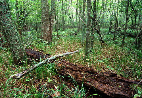
the Lower Chickahominy.” The first year evaluated the habitat of the Lower Chickahominy inclusive of both the Yarmouth and Gordon Watersheds. The 2018 report by Natural Heritage ecologists describe the Lower Chickahominy as “nearly pristine” and representing some of the most impressive fresh tidal vegetation in the Mid Atlantic.
The Commonwealth Department of Environmental Quality has evaluated and rated the areas of the Yarmouth Creek Watershed as Eco Core outstanding (1) and very high (2) for their environmental qualities.

Tidal Sub-watershed – Conservation 1
Figure 11 depicts the Wright Island Virginia Outdoor Foundation (VOF) 823-acre conservation easement.

Sea Level Rise 1.5ft and Yarmouth Creek Tidal sub-watershed
Sea Level Rise 1.5ft and Yarmouth Creek Tidal sub-watershed
As we look to the impact of sea-level rise on the lower Chickahominy, large areas of the Tidal sub-watershed will be inundated around the surrounding area around the mouth of the Yarmouth Creek and along main-stem along with landward migration of the RPA and marshlands. Planning District Commission’s (HRPDC) Sea Level Rise Planning Policy and Approach, uses for planning purpose for the period 2018-2050: a 1.5 feet of sea-level rise above current MHHW (mean higher high water) Figure 12, 13 and 14 show 3 Yarmouth Creek Watershed parcels with Sea Level Rise of 1.5ft (dark blue) indicated the areas of the watershed most effected.
The 2003 Yarmouth Creek Management did document increasing saltwater concentration in the freshwater tidal ecosystem in Yarmouth Creek
Stakeholders at the time described changes in the marsh vegetation as well as an increase in saltwater species, including blue crabs, and fish species such as the croaker further up the Chickahominy River.
Yarmouth Creek is considered one of the two largest relatively undisturbed tidal freshwater wetlands on the lower peninsula by the Virginia Department of Conservation and Recreation (VDCR) (Clampitt, 1991).
“A review of the available data supported the observation that increases in saltwater concentrations are occurring. Though the relative causes of salinity and vegetation changes that have occurred in the Yarmouth Creek watershed may be disputed, Sea Level Rise (SLR) …… will likely continue in Yarmouth Creek.”
Figures 12 shows the predicted inland migrations of 1.5ft of sea-level rise (in blue) from the mouth of the Yarmouth towards the upper main stem of the creek
There may be future conservation opportunities like that of the Wright Island Game Association Figure 11 who have a conservation easement with the Va Outdoor Foundation (VOF) for the other 2 sea-level rise impacted parcels (Figure 13 & 14)


Tidal Sub-watershed – Conservation 7

The one major threat to the Tidal watershed main stem of the Yarmouth Creek is the potential increase of impervious surface by the development of Chickahominy Summerplace a 935 -acre parcel Figure 14. It is located along Jolly Pond Road in the C7 conservation area of the watershed and the entire northern side of the parcel borders the main-stem of the Yarmouth Creek in the Tidal sub-watershed. There was an unsuccessful attempt by the developer/owner to proffer a change to the residential density from 3 acres to 1 acre lots which were rejected by the BoS in 2017. Rezoning this area for a greater density should be rejected if proposed again.

Tidal Watershed -Conservation 3
The one area of concern if it still exists is the Heron Rookery in C3. two of the adjoining parcels should be investigated for potential PDR or AFD inclusion if the Heron Rookery still exists.
C3 Heron Rookery Parcel 2230100044 TOANO FISH & HUNT CLUB on the south Figure 15 North Parcel2230100041 JONS, MONTGOUSSAINT E Parcel2230100032 WALLACE, GEORGE E & REED, BRENDA &
Non-Tidal Watershed -Conservation 4
The non-tidal main stem is currently in a SENSITIVE category with a 1.1% impervious cover. Under the current zoning, it is projected to have a
buildout imperviousness of 3.3% and would remain in the SENSITIVE category.
The majority of the 2045 growth is in the 1839 TAZ which is the Colonial Heritage is (masterplan at 2,000 residential units. There is a 282-acre parcel of Colonial Heritage (Old Boy Scout Camp along Jolly Pond Road) which is in a conservation easement area bordering on the southwest side of Cranston Pond in the upper section of Yarmouth Creek to mitigate impervious cover increases.
Assessment Summary Of Yarmouth Creek Sub-watershed
From an Engage 2045 Comp Plan perspective the overall environmental health of Yarmouth Creek will be dependent on the additional impervious surface in the sub-watersheds103,104 and 105 all of which are all in TAZ 1839. By 2045 TAZ 1839 will increase in population by 4,805 over 2015, the third-highest in population growth in the county by 2045.
The neighborhoods of, Village at Candle Station, Walnut Grove, Colonial Heritage, and Liberty Crossing have a total residential cap of 2,567 units of which 975 are remaining. The rest of the neighborhoods in the TAZ1839 are built out.
There are also two significant parcels totaling 631 acres in TAZ1839 not developed in the 103 and 104 sub-watersheds.

To date in the Yarmouth Creek Watershed the county has invested in 8 stormwaters projects, 2 of which were stream restorations projects at a total cost of $622,144. Projects to date are in the headwaters in sub-watershed 103 and 104.
In the FY 20-24 Capital Investment Program (CIP) the Yarmouth Creek Watershed has two more stream restoration projects at a cost of $1,613,000.
Also the Neighborhood Drainage program from 2016-2018 had 9 projects that in total came to $140,239 of which the county payed $67,178 of that total.
From 2008 to 2024 the county will have spent $2,302322 to mitigate the effects of growth on her watershed
Ecological Integrity Scores Eco Core ratings of 1 & 2
The Commonwealth’s Department of Environmental Quality (DEQ) has assigned Ecological Integrity scores that rate the relative contribution of that area to ecosystem services such as wildlife and plant habitat, biodiversity conservation, water resources protection, erosion control, sediment retention, protection from storm and flood damage, crop pollination, and carbon sequestration. As larger, more biologically diverse areas both are given the highest scores, 1 or 2. Part of this score rating is attributed to the uninterrupted corridors that provide for continued habitat diversity. The Commonwealth has rated both Yarmouth and Gordon areas as outstanding (1) and very high (2) for their environmental qualities. Both the Gordon and Yarmouth watershed are part of Lower Chickahominy and have extensive marshes and swamp forests. The Lower Chickahominy has been described by Natural Heritage ecologists as “nearly pristine” and representing some of the most impressive fresh tidal vegetation in the Mid Atlantic. These ecological scores are reason enough to pursue conservation easements for the Lower Chickahominy areas of the Gordon and Yarmouth watersheds.


Conclusion on the Assessment of Impervious Surface for the Yarmouth Creek Watershed
From an Engage 2045 Comp Plan perspective If growth to the 2045 level takes place more than likely it will occur in TAZ 1821 and 1818 but isolated to the Centerville Rd eastern boundary of the TAZ, which includes the Liberty Ridge (sub-watershed 102) and Westport (sub-watershed 104) developments. These two sub-watersheds are currently sensitive and the future state of 102 remains sensitive and for 104 moves to impacted. which can have a negative downstream impact
Thee is also little doubt about the environmental importance of both the Yarmouth and Gordon Creeks Watershed as part of the Lower Chickahominy. The Commonwealth Department of Environmental Quality has evaluated and rated the areas of the Yarmouth and Gordon Creek Watershed as both Eco Core – 1 outstanding and 2 very high for their environmental qualities Figures 11 above.
Additional comments on both watershed’s environmental importance –
- The sixteen square mile Yarmouth Creek watershed is truly a state treasure.”
- …portions of the watershed as highly significant to biodiversity in the state”
- The Lower Chickahominy as “nearly pristine” and representing some of the most impressive fresh tidal vegetation in the Mid Atlantic.”
In 2003 there was a concern expressed by Yarmouth Creek stakeholders that “the cost of conservation is shared by the entire community, not just individual landowners.” a sentiment likely shared by Gordon Creek shareholder and still valid today. The other half of the discussion is how do we protect this unique environment and what is the cost.
Stay the course
This assessment was undertaken to describe the quantitative impact on the environment and by inference, the qualitative impact on the rural character as well as community character. The assessment outcome was to identify opportunities that would close the gap between what we think is important and what we are not satisfied with. - Preserving rural character – 16% (85% important vs. 69% satisfied)
- Protecting environment – 15% (85% important vs. 70% satisfied)
A large part of this paper is a deep dive into the specific areas of a sub-watershed to determine the future state of its water quality and habitat health by examining the range of their impervious surface cover 0%-10% sensitive but ok 10%-25% impacted and degradation of water quality and habitat health.
Increasing development means increasing impervious cover surface but there are past and ongoing policies, ordinances mitigation strategies that have countered the adverse effects that the county should “Say the Course” with such as –
A well-funded and active green space acquisition program, which has preserved 1,273 acres of land to date;
Ordinances that actively promote conservation easements as tools to meet stormwater management requirements;
A well-funded and active purchase of development (PDR) rights program, which has protected 518 acres of land from development;
A comprehensive watershed planning program that identifies lands needing enhanced stormwater management, targets lands for the green space program, encourages better site design, and identifies stormwater retrofit and improvement opportunities.
The 2045 TAZ 1839 and the four Yarmouth Creek sub-watersheds require close attention if we are to protect a Sensitive rating for the rest of the Yarmouth Watershed
AFD, PDR an Other Conservation Easement Programs
Another part of this paper was examining areas within the watershed that are unique and are defining parts of our rural character. Protecting, Preserving, and Conserving these areas through the Agricultural and Forestry Districts (AFD), Purchase of Development Right (PDR), programs and other conservation easement programs is the other half of the strategy to limit development and protect the Sensitive impervious surface rating for the other sub-watersheds

Figure 20 below shows in red a few of the 300-acre Vacant Parcels in the Gordon Creek Watershed that are also in the Gordon Creek AFD. These AFD parcels are used either for agricultural or forestry only and barred from development for the period they are in the AFD.
The 2008 assessment for Gordon Creek watershed was 86 percent forested with overall impervious cover at just 1.34 percent. That percentage may have increased but not significantly over the last ten years and maintaining those properties in the AFD ensures a continued sensitive rating.
Supporting permanent conservation easements of the 3 parcels in the surrounding Nayses Bay and the Gordon Creek main-stem is a real opportunity to preserve the environment and future marshland habitat with sea-level rise. Water quality in those areas will continue to stay in the sensitive zone and the health of the environmental habitat healthy. A conservation easement would be a better long-term solution to protecting the environments and preserving the rural character.

Gordon & Yarmouth PDR & Greenspace
The county to date has spent $30.1M for the PDR and Green-space and there is an initiative to resume the program. Figures 13 show the PDR parcel (red) in the Gordon creek Watershed and Figure 14 shows the PDR parcels (blue) in the Yarmouth Creek Watershed.
The Gordon Creek PDR conservation easement for the Bush Neck Farm parcel was purchased in 2012 for $1.3M. The Green-space program in the Gordon Creek Watershed has bought outright three parcels two of which buffer he county landfill and the third was the Chickahominy River Front park for $2.27M. The fourth parcel was a partnership between the county and the Historic Rivers Land Conservancy, formally the Williamsburg Land Conservancy for a permanent easement for a section that is part of the VA Capital Trail on Route 5.
The Yarmouth Creek PDR conservation easement for the Geddy and Hall/Temple parcels were purchased in 2003 for $811,000.
The Green-space program in the Yarmouth Creek Watershed has five Green-space parcels, one was bought outright behind Oakland Estates for$1.2M; two are conservation easement parcels for $144,751; a scenic easement on Forge Road for $37,875, and the Geddy/Whitehall parcel at Anderson Corner, which is both a conservation and scenic easement as well as a historic site partner with the Natural Resources Conservation Service.


Ecological Integrity Scores Eco Core ratings of 1 & 2
When viewing the Lower Chikahomniy’s Yarmouth and Gordon Creek Watersheds (Figures 15 & 16) preserving, protecting and conserving these ecological areas with Eco Core ratings of outstanding and very high environmental comes with a shared cost.


The Cost – Agricultural and Forestal Districts (AFD) and Eco Core ratings of 1 & 2
If we total the 56 parcels that have an Eco Core 1 &2 rating in the Yarmouth and Gordon Creek Watersheds have a reduced tax rate. The tax rate totals $84,402 annually. The difference from the full tax rate that county forgoes in tax revenue is $1,407,345 for the 5yr life cycle of the AFD parcels.(Figure 24)
The other 65 parcels in the that have an Eco Core 1 &2 rating in the Yarmouth and Gordon Creek Watersheds pay an annual tax rate of $248,181 (Figure 24)
The AFD program in the Yarmouth Creek Watershed protect the rural character and preserve the environment by buffering the Eco Core 1 & 2 areas and provides wildlife and plant habitat, water resources protection, erosion control, and sediment retention eco-services to the watersheds.

Opportunities
The Yarmouth Creek Watershed is 16 sq. miles and the Gordon Creek Watershed is 13.8 sq. miles for a total of 29,8 sq. miles. 76% of the 29.8 sq. miles of Yarmouth and Gordon is Eco Core 1outstanding and 2 very high.
The future land conservation easement programs should first seek a permanent conservation easement at the non-tidal marshlands at the mouth of both the Yarmouth and Gordon Creeks. With Sea Level Rise, there are real opportunities to preserve the environment and future inland migration of this non-tidal marshland.
By conserving these two non-tidal marshlands of the Gordon and Yarmouth they will continue to sustain the vast array of plant communities that in turn support a wide variety of wildlife. Also, they will continue to mitigate flood damage and filter excess nutrients from surface runoff from both of the watersheds
The Yarmouth conservation easement of 823 acres on the Wright Island Games Association parcel is a great first step. Efforts to examine the possibility for conservation easements of the Chickahominy Summerplace and Daniel’s (Figures 13 & 14) parcel should be examined.
For Gordon Creek, PDR easement of 158 acres on the Bush Neck Farm parcel is another great first step. Supporting permanent conservation easements of the other 3 parcels (Figure 7,8 & 9) in the surrounding Nayses Bay and the Gordon Creek main-stem is another real opportunity to preserve the environment and future marshland habitat with sea-level rise.
In Closing
Not including the five parcels described above, there are 60 remaining Eco Core 1& 2 parcels in both watersheds that are not in the AFD or PDR programs or other conservation easement programs. As a priority those remaining Eco Core 1 parcels should be our next priority to place in either a temporary or permanent conservation easement, followed by the Eco Core 2 parcels.
Increasing saltwater concentration due to sea-level rise will alter the future freshwater tidal ecosystem of both the Yarmouth Creek and Gordon Creek Watersheds. The extent of these changes, while unknown requires further study and investigation.
Not including the five parcels described above, there are 60 remaining Eco Core 1& 2 parcels in both watersheds that are not in the AFD or PDR programs or other conservation easement programs. As a priority those remaining Eco Core 1 parcels should be our next priority to place in either a temporary or permanent conservation easement, followed by the Eco Core 2 parcels.
References
Yarmouth Creek Watershed Master Plan of 2003 by the Center for Watershed Protection (CWP)
Schueler, T.R. 1994. The Importance of Imperviousness. Watershed Protection Techniques. 1(3): 100-111.
The GIS data is that makes up the majority of the graphics in all six papers is from the Hampton Roads Transportation Planning Organization (HRTPO), Janes City County GIS, and the Department of Conservation and Recreation’s Virginia Conservation Lands Database The remains graphics used are from the specific watershed plan
Section A – Details of Sub-Watersheds 102, 103, 104 and 105
The details of their 2003 evaluation for the sub-watersheds 102, 103,104, and 105 are below
Sub-Watershed 102
Neighborhoods – Toano Trace, Hunters Creek Wood, and Oakland
Overall Characterization
This sub-watershed currently has *7.3% impervious cover, and it is projected to have a buildout imperviousness of 11.5%, which would shift its classification from SENSITIVE to IMPACTED

Sub-Watershed 103
Neighborhoods -Village at Candle Station, the other half of Oakland, and Norvalis
Overall Characterization- Subwatershed 103 currently has an impervious cover percentage of 5.1% and is classified as SENSITIVE.
The subwatershed is projected to have a buildout imperviousness of 11.4%, which would shift its classification to IMPACTED.

Sub-Watershed 104
Neighborhoods – the other half of Novalis, FarmVille Estate, Norge Court, Walnut Grove, Kristiansand, Williamsburg Village at Norge Colonial Heritage
Overall Characterization – Sub-watershed 104 is currently in the SENSITIVE category at 9.0% impervious cover and under the current zoning was projected to have a buildout imperviousness of 11.6%, which would shift its classification to IMPACTED. Recently, a significant portion of the sub-watershed was rezoned from agricultural to residential, which shifted the future impervious cover projection to 19.3%.

Sub-Watershed 105
Neighborhoods -the other half of Colonial Heritage in 104, Briarwood Park and Mobile Estates and Lightfoot Marketplace which contains Yarmouth Creek
Overall Characterization – Sub-watershed 105 is currently in the SENSITIVE category with a 5.5% impervious cover. Under the current zoning, this sub-watershed was projected to have a buildout imperviousness of 8.3%, which means it would remain in the SENSITIVE category. Recently, a significant portion of the sub-watershed was rezoned and the new development will shift the classification to IMPACTED and the future impervious cover to 16.7%.

Engage 2045 – Gordon Creek Watershed
Gordon Creek Watershed Overview

Each of the seven completed county watershed plans has an impervious surface assessment for the current time frame of the plan and a future assessment based on the comprehensive plan projection of buildout of added impervious surface. Each watershed is subdivided into sub-watersheds and matched with its TAZ. To make this a bit easier to place the analysis in context, each watershed along with the TAZ also identifies the areas voting precinct. Almost all of the Gordon Creek Watershed is in the Powhatan A voting precinct and contains TAZs 1818 and 1821. So, if you vote in Powhatan A this discussion is about what the future impact of growth could be on your environment and by inference the qualitative impact on its rural character as well as community character

As an example, the Gordon Creek Watershed Master Plan of 2011 assed Stream Condition of Sub-Watershed 104 that contains the Ford’s Colony Westport development with a current Impervious cover of 1.5 % Sensitive and a future impervious cover Impacted at 11.5%.
The 1821 TAZ (Figure 4) includes sub-watershed 102 with Liberty Ridge in addition to sub-watershed 104 with Westport. The 1821 TAZ will from 2015 to 2045 have a potential 352% increase in population to 1,363, a 271% increase in households tp 457 and a 613% increase in vehicles to 1,605. Even with stormwater facilities to mitigate a specific development like a Liberty Ridge and Westport build-out of the additional vacant parcel in the sub-watershed will likely lead to a future impervious cover rating of Impacted with a rating of fair for stream quality of the two sub-watersheds. Also, these two watersheds are headwater sub-watersheds of Gordon Creek Watershed and hurt the entire downstream watershed.

The Gordon Creek watershed is 86 percent forested with overall impervious cover at just 1.34 percent based on a Center for Watershed Protection (CWP) 2008 study. It probably fair to say that the total watershed impervious surface is still rated sensitive today even with the Westport and Liberty Ridge developments. Figure 5 indicates the entire Gordon Creek Watershed with its TAZ showing the overall increase in watershed population, households, and vehicles by 2045

Assessment of Impervious Surface for the Gordon Creek Watershed and conservation consideration for sub-watersheds 102, 104 and 202 based on the projected 2045 growth
TAZ 1821 and Sub-watersheds 102 and 104
If growth to the 2045 level takes place, more than likely it will occur in TAZ 1821 but isolated to the Centerville Rd eastern boundary of the TAZ which includes the Liberty Ridge (sub-watershed 102) and Westport (sub-watershed 104) developments Figure 6. These two sub-watersheds are currently sensitive and the future state of 102 remains sensitive and for 104 moves to impacted.

There are 4 or 5 large vacant parcels in the 300-acre range within the 1821 access will be limited given the county’s abandonment of Jolly Pond Rd across Jolly Pond. Also, a significant number of the vacant parcels in TAZ 1821 are in the Yarmouth and Gordon AFDs.
Conservation Opportunities
From the 2011 Gordon Creek Management Plan on sub-watershed 202 conservation assessment –
“Most of this land is held by private landowners, including several hunt clubs and the Powhatan Association; however, development is largely restricted due to the expansive marshlands surrounding Nayses Bay and the Gordon Creek main-stem and its tributaries, as well as the associated RPA. Existing conditions provide a diverse habitat for a multitude of species of waterfowl and raptors, making these areas ideal candidates for permanent protection. Several old-growth forested islands exist at the mouth of Gordon Creek. They remain undisturbed and contain numerous specimen trees, many with diameters exceeding 40 inches at breast height. Old-growth forests provide potential habitat for sensitive plants, amphibians, and birds such as the bald eagle.” Figure 7

Sea Level Rise 1.5ft and Gordon Creek sub-watershed 202
As we look to the impact of sea-level rise on the lower Chickahominy, large areas of the sub-watershed 202 will be inundated around the surrounding Nayses Bay and the Gordon Creek main-stem along with landward migration of the RPA and marshlands. Planning District Commission’s (HRPDC) Sea Level Rise Planning Policy and Approach, uses for planning purpose for the period 2018-2050: a 1.5 feet of sea-level rise above current MHHW (mean higher high water) Figure 6 Gordon Creek Watershed with Sea Level Rise of 1.5ft (dark blue) indicated the areas of the watershed most effected.
The 2011 Gordon Creek Watershed Management Plan makes no mention of any salinity issues, unlike the 2003 Yarmouth Creek Management which documented increasing saltwater concentration in the freshwater tidal ecosystem.
From the Gordon Creek Baseline Assessment and Conservation Area Plan, January 2008, Center for Watershed Protection (CWP)
“The freshwater tidal marshes of Gordon Creek measure over 900 acres, equating to roughly 10 percent of the total watershed area. The tidal portions of the neighboring watershed of Yarmouth Creek directly to the north are very similar to those of Gordon Creek and have been classified as highly significant to the biodiversity of the state.”
The same Center for Watershed Protection firm wrote the Yarmouth watershed plan and stated that –
“Though the relative causes of salinity and vegetation changes that have occurred in the Yarmouth Creek watershed may be disputed, Sea Level Rise (SLR) …… will likely continue in Yarmouth Creek.”
It is reasonable to assume that the same salinity conditions apply to Gordon Creek Watershed given the Yarmouth is to the north of it and its proximity to the mouth of the Chickahominy. Increasing saltwater concentration due to sea-level rise will alter the future freshwater tidal ecosystem of Gordon Creek Watersheds (Figure 6). The extent of these changes, while unknown requires further study and investigation

There may be future conservation opportunities not unlike that of the Wright Island Game Association also impacted by sea-level rise, to pursue a conservation easement with the Va Outdoor Foundation (VOF) or similar conservation agencies for those hunt clubs and the Powhatan Association. Figures 9-12 are the parcels impacted by the sea-level rise of 1.5ft.


Ecological Integrity Scores Eco Core ratings of 1 & 2
The Eco Core ratings of 1 & 2 (1 red and 2 yellow) for the Gordon Creek Watershed (Figure 11). The Commonwealth’s Department of Environmental Quality (DEQ) has assigned Ecological Integrity scores that rate the relative contribution of that area to ecosystem services such as wildlife and plant habitat, biodiversity conservation, water resources protection, erosion control, sediment retention, protection from storm and flood damage, crop pollination, and carbon sequestration. As larger, more biologically diverse areas both are given the highest scores, 1 or 2. Part of this score rating is attributed to the uninterrupted corridors that provide for continued habitat diversity. The Commonwealth has rated both Yarmouth and Gordon areas as outstanding (1) and very high (2) for their environmental qualities. Both the Gordon and Yarmouth watershed are part of Lower Chickahominy and have extensive marshes and swamp forests. The Lower Chickahominy has been described by Natural Heritage ecologists as “nearly pristine” and representing some of the most impressive fresh tidal vegetation in the Mid Atlantic. These ecological scores are reason enough to pursue conservation easements for the Lower Chickahominy areas of the Gordon and Yarmouth watersheds. The Eco Core ratings of 1 & 2 (1 red and 2 yellow) for the Gordon Creek Watershed (Figure 11). The Commonwealth’s Department of Environmental Quality (DEQ) has assigned Ecological Integrity scores that rate the relative contribution of that area to ecosystem services such as wildlife and plant habitat, biodiversity conservation, water resources protection, erosion control, sediment retention, protection from storm and flood damage, crop pollination, and carbon sequestration. As larger, more biologically diverse areas both are given the highest scores, 1 or 2. Part of this score rating is attributed to the uninterrupted corridors that provide for continued habitat diversity. The Commonwealth has rated both Yarmouth and Gordon areas as outstanding (1) and very high (2) for their environmental qualities. Both the Gordon and Yarmouth watershed are part of Lower Chickahominy and have extensive marshes and swamp forests. The Lower Chickahominy has been described by Natural Heritage ecologists as “nearly pristine” and representing some of the most impressive fresh tidal vegetation in the Mid Atlantic. These ecological scores are reason enough to pursue conservation easements for the Lower Chickahominy areas of the Gordon and Yarmouth watersheds. The Eco Core ratings of 1 & 2 (1 red and 2 yellow) for the Gordon Creek Watershed (Figure 13). The Commonwealth’s Department of Environmental Quality (DEQ) has assigned Ecological Integrity scores that rate the relative contribution of that area to ecosystem services such as wildlife and plant habitat, biodiversity conservation, water resources protection, erosion control, sediment retention, protection from storm and flood damage, crop pollination, and carbon sequestration. As larger, more biologically diverse areas both are given the highest scores, 1 or 2. Part of this score rating is attributed to the uninterrupted corridors that provide for continued habitat diversity. The Commonwealth has rated both Yarmouth and Gordon areas as outstanding (1) and very high (2) for their environmental qualities. Both the Gordon and Yarmouth watershed are part of Lower Chickahominy and have extensive marshes and swamp forests. The Lower Chickahominy has been described by Natural Heritage ecologists as “nearly pristine” and representing some of the most impressive fresh tidal vegetation in the Mid Atlantic. These ecological scores are reason enough to pursue conservation easements for the Lower Chickahominy areas of the Gordon and Yarmouth watersheds.

Conclusion on Assessment of Impervious Surface for the Gordon Creek Watershed
From an Engage 2045 Comp Plan perspective If growth to the 2045 level takes place more than likely it will occur in TAZ 1821 and 1818 but isolated to the Centerville Rd eastern boundary of the TAZ, which includes the Liberty Ridge (sub-watershed 102) and Westport (sub-watershed 104) developments. These two sub-watersheds are currently sensitive and the future state of 102 remains sensitive and for 104 moves to impacted. which can have a negative downstream impact
There is also little doubt about the environmental importance of both the Yarmouth and Gordon Creeks Watershed as part of the Lower Chickahominy. The Commonwealth Department of Environmental Quality has evaluated and rated the areas of the Yarmouth and Gordon Creek Watershed as both Eco Core – 1 outstanding and 2 very high for their environmental qualities Figures 11 above.
Additional comments on both watershed’s environmental importance –
“The sixteen square mile Yarmouth Creek watershed is truly a state treasure.”
“…portions of the watershed as highly significant to biodiversity in the state”
” The Lower Chickahominy as “nearly pristine” and representing some of the most impressive fresh tidal vegetation in the Mid Atlantic.”
In 2003 there was a concern expressed by Yarmouth Creek stakeholders that “the cost of conservation is shared by the entire community, not just individual landowners.” a sentiment likely shared by Gordon Creek shareholder and still valid today. The other half of the discussion is how do we protect this unique environment and what is the cost.
Stay the course
This assessment was undertaken to describe the quantitative impact on the environment and by inference, the qualitative impact on the rural character as well as community character. The assessment outcome was to identify opportunities that would close the gap between what we think is important and what we are not satisfied with.
- Preserving rural character – 16% (85% important vs. 69% satisfied)
- Protecting environment – 15% (85% important vs. 70% satisfied)
A large part of this paper is a deep dive into the specific areas of a sub-watershed to determine the future state of its water quality and habitat health by examining the range of their impervious surface cover 0%-10% sensitive but ok 10%-25% impacted and degradation of water quality and habitat health.
Increasing development means increasing impervious cover surface but there are past and ongoing policies, ordinances mitigation strategies that have countered the adverse effects that the county should “Say the Course” with such as –
A well-funded and active green space acquisition program, which has preserved 1,273 acres of land to date;
Ordinances that actively promote conservation easements as tools to meet stormwater management requirements;
A well-funded and active purchase of development (PDR) rights program, which has protected 518 acres of land from development;
A comprehensive watershed planning program that identifies lands needing enhanced stormwater management, targets lands for the green space program, encourages better site design, and identifies stormwater retrofit and improvement opportunities.
The 2045 TAZ 1821 and 1818 future ratings for sub-watershed 102 and 104 should be relooked at in light of the increasing development of the Liberty Ridge and Westport developments and increasing levels of rainfall. These two sub-watersheds are part of the headwaters of the Gordon Creek watershed and increase development presents a downstream threat to water quality and habitat. Another part of this paper was examining areas within the watershed that are unique and are defining parts of our rural character. Protecting, Preserving, and Conserving these areas through the
AFD, PDR an Other Conservation Easement Programs
Agricultural and Forestry Districts (AFD), Purchase of Development Right (PDR), programs and other conservation easement programs is the other half of the strategy to limit development and protect the Sensitive impervious surface rating for the other sub-watersheds.

Figure 15 below shows in red a few of the 300-acre Vacant Parcels in the Gordon Creek Watershed that are also in the Gordon Creek AFD. These AFD parcels are used either for agricultural or forestry only and barred from development for the period time they are in the AFD.
The 2008 assessment for Gordon Creek watershed was 86 percent forested with overall impervious cover at just 1.34 percent. That percentage may have increased but not significantly over the last ten years and maintaining those properties in the AFD ensures a continued sensitive rating.
Supporting permanent conservation easements of the 3 parcels in the surrounding Nayses Bay and the Gordon Creek main-stem is a real opportunity to preserve the environment and future marshland habitat with sea-level rise. Water quality in those areas will continue to stay in the sensitive zone and the health of the environmental habitat healthy. A conservation easement would be a better long-term solution to protecting the environments and preserving the rural character.

Gordon and Yarmouth PDR & Greenspace
The county to date has spent $30.1M for the PDR and Green-space and there is an initiative to resume the program. Figures 16 show the PDR parcel (red) in the Gordon creek Watershed and Figure 17 shows the PDR parcels (blue) in the Yarmouth Creek Watershed.
The Gordon Creek PDR conservation easement for the Bush Neck Farm parcel was purchased in 2012 for $1.3M. The Green-space program in the Gordon Creek Watershed has bought outright three parcels two of which buffer the county landfill and the third was the Chickahominy River Front park for $2.27M. The fourth parcel was a partnership between the county and the Historic Rivers Land Conservancy, formally the Williamsburg Land Conservancy for a permanent easement for a section that is part of the VA Capital Trail on Route 5.
The Yarmouth Creek PDR conservation easement for the Geddy and Hall/Temple parcels were purchased in 2003 for $811,000.
The Green-space program in the Yarmouth Creek Watershed has five Green-space parcels, one was bought outright behind Oakland Estates for$1.2M; two are conservation easement parcels for $144,751; a scenic easement on Forge Road for $37,875, and the Geddy/Whitehall parcel at Anderson Corner, which is both a conservation and scenic easement as well as a historic site partner with the Natural Resources Conservation Service.


Ecological Integrity Scores Eco Core ratings of 1 & 2
When viewing the Lower Chikahomniy’s Yarmouth and Gordon Creek Watersheds (Figures 18 & 19) preserving, protecting and conserving these ecological areas with Eco Core ratings of outstanding and very high environmental comes with a shared cost.


The Cost – Agricultural and Forestal Districts (AFD) and Eco Core ratings of 1 & 2
If we total the 56 parcels that have an Eco Core 1 &2 rating in the Yarmouth and Gordon Creek Watersheds have a reduced tax rate. The tax rate totals $84,402 annually. The difference from the full tax rate that county forgoes in tax revenue is $1,407,345 for the 5yr life cycle of the AFD parcels.(Figure 20)
The other 65 parcels in the that have an Eco Core 1 &2 rating in the Yarmouth and Gordon Creek Watersheds pay an annual tax rate of $248,181 (Figure 20)
The AFD program in the Gordon and Yarmouth Creek Watersheds protect the rural character and preserve the environment by buffering the Eco Core 1 area and provides wildlife and plant habitat, water resources protection, erosion control, and sediment retention eco-services to the watersheds.

Opportunities
The Yarmouth Creek Watershed is 16 sq. miles and the Gordon Creek Watershed is 13.8 sq. miles for a total of 29,8 sq miles. 76% of the 29,8 sq. miles of Yarmouth and Gordon is Eco Core 1outstanding and 2 very high.
The future land conservation easement programs should first seek a permanent conservation easement at the non-tidal marshlands at the mouth of both the Yarmouth and Gordon Creeks. With Sea Level Rise, there are real opportunities to preserve the environment and future inland migration of this non-tidal marshland.
By conserving these two non-tidal marshlands of the Gordon and Yarmouth they will continue to sustain the vast array of plant communities that in turn support a wide variety of wildlife. Also, they will continue to mitigate flood damage and filter excess nutrients from surface runoff from both of the watersheds
The Yarmouth conservation easement of 823 acres on the Wright Island Games Association parcel is a great first step. Efforts to examine the possibility for conservation easements of the Chickahominy Summerplace and Daniel’s parcel should be examined.
For Gordon Creek, PDR easement of 158 acres on the Bush Neck Farm parcel is another great first step. Supporting permanent conservation easements of the other3 parcels (Figure 7,8 & 9) in the surrounding Nayses Bay and the Gordon Creek main-stem is another real opportunity to preserve the environment and future marshland habitat with sea-level rise.
In Closing
Increasing saltwater concentration due to sea-level rise will alter the future freshwater tidal ecosystem of both the Yarmouth Creek and Gordon Creek Watersheds. The extent of these changes, while unknown requires further study and investigation. Prototyping work by VIMS on modeling tidal marshes to simulate and assess the evolution and persistence of tidal marshes under different sea-level rise scenarios. Further study should be actively pursued by the Commonwealth or in partnership with the county since it has interests on the effects of sea-level rise on county marshlands along the Lower Chickahominy and James River
Not including the five parcels described above, there are 60 remaining Eco Core 1& 2 parcels in both watersheds that are not in the AFD or PDR programs or other conservation easement programs. As a priority those remaining Eco Core 1 parcels should be our next priority to place in either a temporary or permanent conservation easement, followed by the Eco Core 2 parcels.
References
Gordon Creek Watershed Center for Watershed 2008 Protection Center for Watershed Protection (CWP)
Schueler, T.R. 1994. The Importance of Imperviousness. Watershed Protection Techniques. 1(3): 100-111.
The GIS data is that makes up the majority of the graphics in all six papers is from the Hampton Roads Transportation Planning Organization (HRTPO), Janes City County GIS, and the Department of Conservation and Recreation’s Virginia Conservation Lands Database The remains graphics used are from the specific watershed plan
Engage 2045 – Ware Creek Watershed
Ware Creek Watershed Overview

As an example, the Ware Creek Watershed Master Plan of 2016 of the five sub-watershed assed stream condition of France Swamp (FRS) has the highest percentage of impervious area at 9.5% (417.8 acres) Figure 2) . In 2016 it was rated as Sensitive (under 10% impervious cover). The future Impervious cover is 14.9% (656.5 acres) and is rated as Impacted (impervious Cover 10%-25%
Each of the seven completed county watershed plans has an impervious surface assessment for the current time frame of the plan and a future assessment based on the comprehensive plan projection of buildout of added impervious surface. Each watershed is subdivided into sub-watersheds and matched with its TAZ. To make this a bit easier to place the analysis in context, each watershed along with the TAZ also identifies the areas voting precinct. Almost all of the Ware Creek Watershed covers half of Stonehouse C precinct and half of Stonehouse A voting precinct and contains TAZs 1826,18227, 1841 and 1842 (Figure 3). So if you vote in Stonehouse A or C, this discussion is about what the future impact of growth could be on your environment and by inference the qualitative impact on its rural character as well as community character.

Ware Creek Watershed – Overview

Approximately 74% of the Ware Creek watershed is undeveloped. Much of the land within the
watershed is owned by a large developer and is slated to be developed into either residential or
commercial properties in the future. Approximately 6,050 acres or 52% of the overall watershed is zoned as existing residential or proposed residential, though only about 60% of that land has been built out to date.
Impervious cover in the Ware Creek watershed totals 670 acres, which accounts for 5.9 percent of the total watershed area. The majority of the impervious cover is associated with neighborhoods populated by single-family homes in the western and southern part of the watershed and commercial/industrial development in the southern part of the watershed. Thirty subdivisions lie within the Ware Creek watershed, most notably the 1,145-acre Stonehouse development in the western portion of the watershed (Figure 4)
Assessment of Impervious Surface for the Ware Creek Watershed and conservation consideration for the Frances Swamp, Upper WareCreek, Cow, Folly, and Lower Ware Creek sub-watershed based on the projected 2045 growth

TAZ 1842,1827 and France Swamp (FRS) Sub-watersheds
The France Swamp sub-watershed FRS extends from Croaker Rd on the southeast up to Toano and extends up Route 60 to Anderson Corner ending on the west side in the Stonehouse Industrial Park (Figure 5) On the north side it extends into TAZ 1826 and a portion of the Stonehouse development just across Interstate 64 into an area about 500 acres zoned PUD. This area is apart of the Stonehouse residential development

Residential subdivisions within the sub-watershed include Weatherly, Fenwick Hill, Temple Hall Estates, White Hall North and South, Great Woods, Wellington, Mirror Lake Estates, Elmwood, Glenwood Acres, Burnt Ordinary, and Toano Terrace (Figure 6). The Industrial Boulevard Industrial Park and commercial businesses located in Toano represent a significant concentration of impervious surfaces.
Of the five sub-watershed assed stream conditions of France Swamp (FRS) has the highest percentage of impervious area at 9.5% (417.8 acres). In 2016 it was rated as Sensitive (under 10% impervious cover). The future Impervious cover is 14.9% (656.5 acres) and is rated as Impacted (impervious Cover 10%-25%.
With the addition of another 669 households by 2045, it is not difficult to see the future impervious cover for the FRS in the Impacted range of 10%-25%. Figure 5 below.
The FRS extends across Interstate 64 into the Stonehouse residential development which was recently granted a downzoning. The result was a shifting of residential units resulting in an additional 1,150 residential units within the 735 acres. These population, household and vehicle adjustments are ~not~ in the TAZ 1826 2045 data.
With the addition of another 669 households by 2045 in the TAZ s 1827 and 1842 (Figure 7), it is not difficult to see the future impervious cover for the FRS in the Impacted range of 10%-25% without factoring the additional 1.150 residential units in Stonehouse that are in the FRS.

TAZ 1841 and Upper Ware Creek (UWC) sub-watershed

The Upper War Creek sub-watersheds southern boundary mostly follows Old Stage Road and drains to Upper Ware Creek. Upper Ware Creek conveys to the north through BirdSwamp and ultimately draining to Richardson Millpond. The Stonehouse development is the only residential subdivision with a 2018 count of 681 units. TAZ 1841 in 2045 is projecting 2,164 Figure 8).
The Stonehouse residential development was recently granted a downzoning which capped the Total Stonehouse residential units at 3,646 units. The adjusted Stonehouse residential units in the Upper Ware Creek sub-watershed is 192 residential units.
The 1841 TAZ covers the majority of the developed Stonehouse residential development and sub-watershed has the *second-highest percentage of impervious area at 7.4% (224.9 acres). Future impervious 12.1% (336.9 acres) based on the 2016 Ware Creek Watershed Management Plan. Even with a downzoning of the Stonehouse development, the 2045 household count will likely not alter the Future impervious cover from Impacted (10%-25% range).

TAZ 1826 and Cow Swamp, Folly Swamp and Lower Ware Sub-watershed
TAZ 1826 encompasses all of Cow Swamp, Folly Swamp and LowerWare Creek Sub- Watershed and a portion of France Swamp Sub-watershed by Interstate 64 and bordering TAZ 1842 ( Figures 9 & 10)
It consisted of 3,973 acres, is predominantly forest and wetlands and has a current impervious surface cover of .07%, Sensitive (0%-10% range)


Cow Swamp Sub-watershed is 1,826 acres in size with only 0.8 percent impervious cover
mostly associated with roads and parking lots
From Croaker Road and Ware Creek Road, the sub-watershed drains to Cow Swamp ultimately joining France Swamp at the confluence with Ware Creek. The vast majority of the sub-watershed is forest and wetlands. The 2016 plan projected a future condition impervious surface cove of 10.2%
Folly Swamp Sub-watershed consists of 1,195.6 acres, with 83 percent of the area made up of forested land, nine percent wetlands, and six percent in residential uses. Total impervious cover is 9.9 acres or 0.8 percent. Approximately half of the impervious cover is represented by roads and parking lots. The 2016 plan projected a future condition impervious surface cove of 3.7% Sensitive. Total impervious cover is projected to increase to 150.4 acres or 12.6 %, Impacted
Lower Ware Creek Sub-watershed is 952 acres in size with only 0.6% impervious cover (Sensitive)
mostly associated with roads and parking lots. The sub-watershed, which is predominantly forest and wetlands, drains to FranceSwamp then ultimately joining Ware Creek. The vast majority of the sub-watershed is forest and wetlands. The 2016 plan projected a future condition impervious surface cove of 10.2% (borderline Sensitive). The majority of future impervious areas will be from planned residential and commercial development.
Cow Swamp, Folly Swamp, and Lower Ware Sub-watershed Future Impervious Surface Cover.
The future impervious surface cover does not factor in the recent downzoning of the Stonehouse residential development on Dec 2019 with a reduction of 1,254 residential units. The Stonehouse Reserve and Riverfront Reserve represent about 2,306 acres which will convert from PUD to A-1 zoning with an easement of only 19 units.
The Stonehouse Reserve is about 1946 acres and there are proposed offer of the property to the Commonwealth as an addition to the adjacent Ware Wildlife Reserve. In any case, the future impervious surface cover for Cow and Folly Swamps sub-watersheds is likely to remain at about .07%, a level of Sensitive (0%-10%).
The Lower Ware Creek sub-watershed is likely to see the addition of 1.050 residential unit over 771 acres and likely to have a Future impervious cover bordering on Sensitive at 10%.
The socio-economic data for TAZ 1826 (Figure 11) requires adjustments base on the downzoning of Stonehouse residential development.

Conclusion on the Assessment of Impervious Surface for the Ware Creek Watershed
The downzoning of the Stonehouse development still retains a maximum density of 2,392 PUD units and 19 A1 unit but the rezoning of 2,306 acres to A-1 means a large portion will remain in the forest, agricultural, open space, meadows, and wetlands. The 2011 impervious surface current and future ratings for sub-watershed FRS and UWC will most likely in the future move to Impacted but in the lower band (10%-25%). For the FRS unknowns is the potential mitigation on water quality since identified stream restoration and outfall projects are un-programmed in the CIP and should be pursued.
To date in the Ware Creek Watershed the county has invested in the Neighborhood Drainage program from 2016-2018 with 8 projects that in total came to $111,569 of which the county paid $52,254 of that total.
Conclusion Ware Creek Watershed and TAZs
From an Engage 2045 Comp Plan perspective If growth to the 2045 level takes place more than likely it will still occur in TAZ 1826 even with the recent downzoning.
Looking at all four TAZs, the current TAZs 2045 population projection for the Ware Creek Watershed is 289% above the current 2015 levels. The Stonehouse downzoning reduction of 1,235 residential units would represent about a little over 3,000 in population This would reduce the Ware Creek Watershed 2045 population to about19,000 and would still mean a projected population increase of 236% (2015 pop 5,679; 2045 population about 19,000) (Figure 12)

Ecological Integrity Scores Eco Core ratings of 1 & 2
The Commonwealth’s Department of Environmental Quality (DEQ) has assigned Ecological Integrity scores that rate the relative contribution of that area to ecosystem services such as wildlife and plant habitat, biodiversity conservation, water resources protection, erosion control, sediment retention, protection from storm and flood damage, crop pollination, and carbon sequestration. As larger, more biologically diverse areas both are given the highest scores, 1 or 2. Part of this score rating is attributed to the uninterrupted corridors that provide for continued habitat diversity. The Commonwealth has rated the Cow Swamp and Folly Swamp sub-watersheds an outstanding Figure 1

Sea Level Rise 1.5ft and the Ware Creek Watershed
Planning District Commission’s (HRPDC) Sea Level Rise Planning Policy and Approach, use for planning purposes for the period 2018-2050: 1.5 feet of sea-level rise above current MHHW (mean higher high water. The impact of sea-level rise in the watershed is along the main stem of Ware Creek and has a significant inland migration and expanse of the non-tidal marshlands as far as the northern tip of the Lower Ware Creek sub-watershed. Impediments to the inland migration by development is a non-issue at this point but a plus for the future expansion of marshland habitat with sea-level rise
The 2016 Ware Creek Watershed Management Plan makes no mention of any salinity issues, unlike the 2003 Yarmouth Creek Management which documented increasing saltwater concentration in the freshwater tidal ecosystem. It is reasonable to assume that with a sea-level rise that salinity and vegetation changes will occur in the dark blue areas of the Ware Creek (Figure 16). Sea-level rise will alter the future freshwater tidal ecosystem of the Ware Creek Watersheds. The extent of these changes, while unknown requires further study and investigation

Stay the course
This assessment was undertaken to describe the quantitative impact on the environment and by inference, the qualitative impact on the rural character as well as community character. The assessment outcome was to identify opportunities that would close the gap between what we think is important and what we are not satisfied with.
- Preserving rural character – 16% (85% important vs. 69% satisfied)
- Protecting environment – 15% (85% important vs. 70% satisfied)
A large part of this paper is a deep dive into the specific areas of a sub-watershed to determine the future state of its water quality and habitat health by examining the range of their impervious surface cover 0%-10% sensitive but ok 10%-25% impacted and degradation of water quality and habitat health.
Increasing development means increasing impervious cover surface but there are past and ongoing policies, ordinances mitigation strategies that have countered the adverse effects that the county should “Say the Course” with such as –
A well-funded and active green space acquisition program, which has preserved 1,273 acres of land to date;
Ordinances that actively promote conservation easements as tools to meet stormwater management requirements;
A well-funded and active purchase of development (PDR) rights program, which has protected 518 acres of land from development;
A comprehensive watershed planning program that identifies lands needing enhanced stormwater management, targets lands for the green space program, encourages better site design, and identifies stormwater retrofit and improvement opportunities.
The 2045 TAZ 1842,1827 and France Swamp (FRS) Sub-watersheds are at the headwaters of the Ware Creek Watershed. The impact of the future development in of 1.150 residential units in the Stonehouse section of France Swamp is unknown but likely the sub-watershed will in 2045move into the Impacted impervious surface cover range of 10%-25% and adversely affect the Lower Ware, CowSwamp and Folly Swamp sub-watersheds. The Ware Creek Watershed Plan has identified several stormwater projects in areas in the France Swamp and there is an ongoing funded stormwater project in the Toanao area.
AFD, PDR an Other Conservation Easement Programs
Another part of this paper was examining areas within the watershed that are unique and are defining parts of our rural character. Protecting, Preserving, and Conserving these areas through the Agricultural and Forestry Districts (AFD), Purchase of Development Right (PDR), programs and other conservation easement programs is the other half of the strategy to limit development and protect the Sensitive impervious surface rating for the other sub-watersheds.
AFD
Figure 15 below indicates the watersheds AFDs temporary conservation easement parcels The Barnes Swamp AFD in dark blue is in the Upper ware Creek sub-watershed and TAZ 1841. The Croaker AFD in light Blue is part of the Cow Swamp and Folly Swamp sub-watersheds. Both AFDs are outside of the PSA and zoned A-1 and Rural Lands in the 2035 Comp Plan. Figure 16 shows the parcels in the watershed that are over 100 acres in size and vacant/not developed i(red). The majority of the vacant parcels are in either the Barnes Swamp or Croaker AFD except for a 416-acre parcel 1410100013
York River Estates, LC
The 150 acres Wenger Farms LLC, parcel 1410100001 in the Croaker AFD and the 416-acre parcel 1410100013, York River Estates, LC are partially in and border the Eco core 1 area in the Cow Swamp sub-watersheds. The 62 acre Croaker AFD parcel belonging to Thomas W. Dana parcel0720100006 on Sycamore Landing is completely in the Eco Core 1 area of the Folly Swamp sub-watershed.
The Barnes Swamp and Croaker AFD parcels in the Upper Ware Creek, Cow Swamp, and Folly Swamp sub-watersheds along with the York River Estates contribute directly to the current Sensitive impervious surface ratings of 7.4%, .08%, and .08% respectively 0%-10% Sensitive).
The loss of these parcels to development would lead to elevated impervious levels.
The Future impervious level for the Upper Ware Creek sub-watershed is currently forecasted at the impacted range of 12.1% (10%-25% Impacted) with the build-out of the Stonehouse development. The loss of any of Barnes Swamp AFD parcels to development would only elevate the level of Impacted in the sub-watershed.


The Cost – Agricultural and Forestal Districts (AFD) and Eco Core ratings of 1
Figure 17 shows the Ware Creek Eco Core 1 with AFD parcel fully or partially contained and Vacant over 100-acre parcels outline in red
Figure 18 The tax rate totals $2,023 annually. The difference from the full tax rate that county forgoes in tax revenue is $63,870 for the 5yr life cycle of the AFD parcel.(Figure 24)
The other 2 parcels partially in Eco Core 1 rating in the Ware Creek Watersheds pay an annual tax rate of $30,399.84. Because of the two parcels in at the Croaker AFD, the county forgoes $37,096.60 over the five life cycles of the AFD parcel (Figure 28).
The AFD program in the Ware Creek Watershed protect the rural character and preserve the environment by buffering the Eco Core 1 area and provides wildlife and plant habitat, water resources protection, erosion control, and sediment retention eco-services to the sub-watersheds.
Figure 18 The Ware Creek Watershed AFD’s tax rate totals $2,023 annually. The difference from the full tax rate that county forgoes in tax revenue is $63,870 for the 5yr life cycle of the AFD parcel. (Figure 24)
The other 2 parcels partially in Eco Core 1 rating in the Ware Creek Watersheds pay an annual tax rate of $30,399.84. Because of the two parcels in at the Croaker AFD, the county forgoes $37,096.60 over the five-life cycle of the AFD parcel (Figure 19).
The AFD program in the Ware Creek Watershed protect the rural character and preserve the environment by buffering the Eco Core 1 area and provides wildlife and plant habitat, water resources protection, erosion control, and sediment retention eco-services to the sub-watersheds.


PDR
The county to date has spent $30.1M for the PDR and Green-space and there is an initiative to resume the program. Figure 20 shows the PDR parcels (blue). The White Hall Geddy farm in blue), was built about 1805, and is one of the oldest structures in James City County and is currently owned by a descendant of William Geddy, the original property owner. The Geddy family has owned the surrounding land since 1780. The White Hall Geddy Farm is a great example of the PDR’s efforts to preserve the rural character and historical history of the county.

Opportunities
The addition of the Stonehouse Reserve’s 2,314 acres as an addition to the adjacent Ware Wildlife Reserve is a once in a lifetime opportunity. The conservation and preservation of this area to the ecosystem services such as wildlife and plant habitat, biodiversity conservation, water resources protection, erosion control, sediment retention, protection from storm and flood damage, crop pollination, and carbon sequestration is huge
In Closing
Sea-level rise will alter the future freshwater tidal ecosystem of the Ware Creek Watersheds. The extent of these changes, while unknown requires further study and investigation. Prototyping work by VIMS on modeling tidal marshes to simulate and assess the evolution and persistence of tidal marshes under different sea-level rise scenarios. Further study should be actively pursued by the Commonwealth or in partnership with the county since it has interests on the effects of sea-level rise on county marshlands along the Lower Chickahominy and James River As a priority, the Stonehouse Reserve Eco Core 1 parcels should be the priority to place in permanent conservation easement with the Commonwealth or with a conservation agency
**References
Ware Creek Watershed Master Plan of 2016 by Vanasse Hangen Brustlin, Inc (VHB) and KCI Technologies (KCI)
Schueler, T.R. 1994. The Importance of Imperviousness. Watershed Protection Techniques. 1(3): 100-111.
White Hall, built about 1805, is one of the oldest structures in James City County and is currently owned by a descendant of William Geddy, the original property owner. The Geddy family has owned the surrounding land since 1780,
Lewis, Sara E. James City County Images of America. Arcadia Publishing. Kindle Edition.
The GIS data is that makes up the majority of the graphics in all six papers is from the Hampton Roads Transportation Planning Organization (HRTPO), Janes City County GIS, and the Department of Conservation and Recreation’s Virginia Conservation Lands Database The remains graphics used are from the specific watershed plan
Engage 2045 – Skimino/York Creek Watershed
Skimino Creek – York River Watershed – Overview


The Skimino Creek Watershed is approximately 29 percent urbanized with 20 percent of the watershed in residential, 4 percent in transportation uses, and 5 percent in commercial and institutional areas. The major transportation corridors in the watershed are I-64, which crosses close to the border between the Barlow’s Mill Pond and Fenton Mill Pond sub-watersheds, Croaker Road, which tracks the northwestern boundary of the watershed, and Richmond Road, along the southwestern boundary. The watershed is largely rural land (71 percent of the watershed). Forest makes up the majority of the undeveloped land, totaling 50 percent of the watershed. Agricultural land use makes up 7 percent of the watershed with 10 percent being open water and wetlands, and about 2 percent in open space/meadow. Figure 4 is the Skimino Creek watershed TAZs and Voting Districts and Figure 5 the Skimino Creek watershed neighborhoods


Assessment of Impervious Surface for the Skimino Creek Watershed


The Skimino Creek Watershed contains approximately 368 impervious acres, for an overall watershed imperviousness of 3.8 percent (Figures 6 & 7). Fenton Mill Pond is the only watershed over 10 percent impervious of which the majority of the impervious cover located along Richmond Road at the uppermost portion of the Skimino Creek watershed
The Fenton Mill Pond (FMP) sub-watershed

The Fenton Mill Pond (FMP) sub-watershed covers 1,406 acres (Figure 8) The impervious cover acreage is 147.8 acres a10.5 percent impervious. Fenton Mill Pond includes all of TAZ 1829 (Figure 7).

The 2018 Skimino/York watershed management plan did not project a future build-out scenario or indicate the state of the impervious surface under that build-out scenario. It is reasonable to assume give the Economic Opportunity designation of a large area of the FMP sub-watershed that a future build-out scenario would reduce the current acres of agriculture and forest and at the same time add impervious surface from the Economic Opportunity development. Figure 8 is TAZ 1829 that includes all of Fenton Mill Pond. The 2045 Household growth of 2,869 or a 2,190% increase represents a significant addition of impervious surface as well as the accompanying added addition from roads. It is reasonable to assume that the 10.5% would move from a borderline Impacted state to solidly in the Impacted zone of 10%- 25%.
The Barlow’s Mill Pond, Upper Taskinas Creek, Lower Skimino Creek, York River Direct 1 & 2 (YR1/2) Sub-watersheds fall in their entirety into TAZs 1830 and 1843

The impervious surface for Barlow’s Mill Pond (Figure 10) is 4.2%, Upper Taskinas Creek is 6.4%, Lower Skimino Creek is 1%, and the York River 2 is 6.8%. (Figure 9)The subdivision within the sub-watershed is essentially built out except for York River 2 whose Riverview Plantation has 22 vacant parcels out of 100.
Figure 9 shows TAZ 1830 and 1843 socio-economic data which includes Barlow’s Mill Pond, Upper Taskinas Creek, Lower Skimino Creek, York River 2 Sub-watersheds. The 2045 population and vehicles are slightly reduced in number from 2015 and the number of households increases by 86 in 2045 (Figure 11). There are currently 56 vacant parcels in all of the sub-watersheds.
If the vacant parcels over 100 acres remain undeveloped in this sub-watershed it is fair to say that the future impervious surface for them will remain in the Sensitive impervious cover range 0%-10%

The details of the current impervious surface for the Barlow’s Mill Pond, Upper Taskinas Creek, Lower Skimino Creek, York River 2 sub-watersheds are in Section A
Assessment of Impervious Surface for the Skimino Creek Watershed
For the Barlow’s Mill Pond, Upper Taskinas Creek, Lower Skimino Creek, York River 2 sub-watersheds Future rating remain in the Sensitive impervious cover range 0%-10%.
Sea Level Rise 1.5ft and the Skimino Creek Watershed
To date in the Skimino/York Creek Watershed the county has invested in 4 stormwaters projects, 1 of which were stream restorations projects at a total cost of $422,944 to mitigate these 2018 known issues. In the FY 20-24 Capital Investment Program (CIP) the Skimino Creek Watershed has several retrofit projects at a cost of $1,502,000. The future issue for the Skimino Watershed revolves around the development of Fenton Mill Pond sub-watershed. If the Economic Opportunity comes to pass the projected 2045 Household growth of 2,869 or a 2,190% increase represents a significant addition of impervious surface as well as the accompanying added addition from roads. It is reasonable to assume that the 10.5% would move from a borderline Impacted state to solidly in the Impacted zone of 10%- 25%. The Fenton Mill Pond sub-watershed is at the headwaters of Skimino Creek and the future increase of impervious surface will likely impact the Lower Skimino Creek sub-watershed bordering Skimino Creek
The Planning District Commission’s (HRPDC) Sea Level Rise Planning Policy and Approach, use for planning purposes for the period 2018-2050: 1.5 feet of sea-level rise above current MHHW (mean higher high water. The impact of sea-level rise in the watershed is along the main stem of both Skimino Creek and Taskinas Creek. There is a significant inland migration and with the unobstructed expansion of the nontidal marshlands of both creeks.
The 2018 Skimino Creek – York River Watershed Management Plan makes no mention of any salinity issues, unlike the 2003 Yarmouth Creek Management which documented increasing saltwater concentration in the freshwater tidal ecosystem.
It is reasonable to assume that with a sea-level rise that salinity and vegetation changes will occur in the dark blue areas of both the Skimino Creek and Taskinas Creek (Figure 12). Sea-level rise will alter the future freshwater tidal ecosystem of the both Skimino Creek and Taskinas Creeks. Both creeks are in York State Park. The extent of these changes, while unknown requires further study and investigation. One of the ongoing research projects by Karinna Nunez, Virginia Institute of Marine Science (VIMS) is a modeling effort of tidal marshes to simulate and assess the evolution and persistence of tidal marshes under different sea-level rise scenarios. The intended outcome is “highly resolved outputs that will allow coastal planners to more accurately identify the potential future location of marsh habitats where protection and restoration activities can be focused to increase tidal marsh resilience.” The initial development of her model prototyped the Taskinas Creek marshlands.

Stay the course
This assessment was undertaken to describe the quantitative impact on the environment and by inference, the qualitative impact on the rural character as well as community character. The assessment outcome was to identify opportunities that would close the gap between what we think is important and what we are not satisfied with.
- * Preserving rural character – 16% (85% important vs. 69% satisfied)
- * Protecting environment – 15% (85% important vs. 70% satisfied)
A large part of this paper is a deep dive into the specific areas of a sub-watersheds to determine the future state of its water quality and habitat health by examining the range of their impervious surface cover 0%-10% sensitive but ok, 10%-25% impacted and degradation of water quality and habitat health.
Increasing development means increasing impervious cover surface but there are past and ongoing policies, ordinances mitigation strategies that have countered the adverse effects that the county should “Say the Course” with such as –
A well-funded and active green space acquisition program, which has preserved 1,273 acres of land to date;
Ordinances that actively promote conservation easements as tools to meet stormwater management requirements;
A well-funded and active purchase of development (PDR) rights program, which has protected 518 acres of land from development;
A comprehensive watershed planning program that identifies lands needing enhanced stormwater management targets lands for the green space program, encourages better site design and identifies stormwater retrofit and improvement opportunities.
AFD, PDR an Other Conservation Easement Program
Another part of this paper was examining areas within the watershed that are unique and are defining parts of our rural character. Protecting, Preserving, and Conserving these areas through the Agricultural and Forestry Districts (AFD), Purchase of Development Right (PDR), programs and other conservation easement programs is the other half of the strategy to limit development and protect the Sensitive impervious surface rating for the sub-watersheds.
AFD
Figure 13 below shows the watersheds AFDs Croaker AFD in light blue (Barlow Mill Pond sub-watershed), Christianson’s Corner AFD salmon (Lower. Skimino Creek sub-watershed,) and Hillcrest Farm AFD in brown (Fenton Mill Pond sub-watershed). The AFD is a temporary conservation easement preventing the development of the parcel temporarily for a five year period. A large portion of the AFDs in the watershed is forested and provide a range of eco-services that help protect the environment.

The Cost – Agricultural and Forestal Districts (AFD)

Figure 14 shows the Skiimino Creek AFD parcels outlined in red that are undeveloped greater than100 acres.
The Skimino Watershed AFD’s tax rate totals $38,306 annually. The difference from the full tax rate that county forgoes in tax revenue is $479,638 for the 5yr life cycle of the AFD parcel.
The AFD program in the Skimino Watershed protect the rural character and preserve the environment. In the case of the Christian’s Corner AFD, it acts as a buffer for theYork State Park.
PDR & Greenspace
The county to date has spent $30.1M for the PDR and Green-space Program and there is an initiative to resume the program. Figures 15 show the Aperson PDR parcel (light blue ) the only one in the Skimino Creek Watershed. The conservation easement for the Aperson parcel purchased in 2016 for $577,223.

Figure 16 shows all of the temporary conservation easements AFDs and permanent conservation easements Asperson PDR, and 2 Historic Virginia Land Conservancy (HVLC) parcels in dark red

Opportunities
The Fenton Mill Pond sub-watershed would lose the three Hillcrest Farm AFDs if the Economic Opportunity area becomes a future reality. It would also move the area into the PSA triggering additional public services. The growth that would accompany it would have an adverse impact on a sub-watershed impervious cover moving it solidly into the Impacted range 10%-25%.
There is an opportunity during the 2045 Engage Comp Plan to revisit that 2009 decision and rescind the Economic Opportunity designation and maintaining its current Rural designation in the land use of the comp plan and not in the PSA.
The conservation and preservation of this area to the ecosystem services such as wildlife and plant habitat, biodiversity conservation, water resources protection, erosion control, sediment retention, protection from storm and flood damage, crop pollination, and carbon sequestration is huge.
In Closing
Sea-level rise will alter the future freshwater tidal ecosystem of Skimino Creek and Taskinas Creeks in the Watersheds. The extent of these changes, while unknown requires further study and investigation. Prototyping work by VIMS on modeling tidal marshes to simulate and assess the evolution and persistence of tidal marshes under different sea-level rise scenarios. Further study should be actively pursued by the Commonwealth or in partnership with the county since it has interests on the effects of sea-level rise on county marshlands along the Lower Chickahominy and James River
References
Skimino Creek – York River Watershed Management Plan, 2018 by Vanasse Hangen Brustlin, Inc (VHB) and KCI Technologies (KCI)
Schueler, T.R. 1994. The Importance of Imperviousness. Watershed Protection Techniques. 1(3): 100-111.
The GIS data is that makes up the majority of the graphics in all six papers is from the Hampton Roads Transportation Planning Organization (HRTPO), Janes City County GIS, and the Department of Conservation and Recreation’s Virginia Conservation Lands Database The remains graphics used are from the specific watershed plan
Section A
Barlow Mill Pond Sub-watershed
Barlow’s Mill Pond sub-watershed is the second largest of the six evaluated sub-watersheds in the watershed at 2,313.5 acres (Figure 2-1). It has a low percentage of impervious area at 4.2% (96.2acres). The southern boundary is located along the boundary of the James City County boundary. The BMP watershed flows to Barlows Pond which has an outlet at Newman Road (SR 646) where it becomes
the headwaters of Skimino Creek in the LSC sub-watershed.
The majority of BMP sub-watershed is forest, with single-family rural wooded residential land and making up other significant land uses. Residential subdivisions within the sub-watershed include North Cove 3, Broughton Tract 1, Westbank Farms 2, and Wexford Hills 13. The majority of the impervious surface within the BMP sub-watershed is associated with transportation, primarily roads. Almost half of the sub-watershed is mapped as wetlands and forested areas.
Upper Taskinas Creek (UTC) Sub-watershed
The Upper Taskinas Creek sub-watershed is the third largest of the evaluated sub-watersheds in the York River watershed at 1,465.26 acres (Figure 6-1). It is 6.4% impervious. The sub-watershed southern boundary is located along Riverview Road. The western boundary is approximately Croaker Road (SR 607) and the
York River State Park is the approximate border to the north and east.
The majority of UTC sub-watershed is single-family rural wooded and forest. Residential subdivisions within the sub-watershed include the Benamine Fenton Estate 0, Henry Thyysen 0, Ware Creek Manor 1, and Woodland Farms 14. The majority of the impervious surface within the UTC sub-watershed is associated with roads and parking facilities. Thirty-five percent of the sub-watershed is mapped as water, wetlands and forested area.
Lower Skimino Creek (LSC) Sub-watershed
Lower Skimino Creek is 1,049.9 acres in size (Figure 2-1). It has the lowest percentage of impervious area of the six evaluated sub-watersheds at 1.0% (10.5acres). The southern boundary is the James City County line that follows Lower Skimino Creek.. The western border is roughly along Newman Road (SR 646) and the northern boundary follows Riverview Road
The majority of LSC sub-watershed is forest, including an area of harvested forest. Other major land uses are agriculture and water/wetlands, There is small areas of single-family residential in the most northern portion of the sub-watershed and along the western border. There are no residential subdivisions located within the sub-watershed. The majority of the impervious surface within the LSC sub-watershed is associated with roads.
York River Direct 1 (YR1) Sub-watershed
YR1 sub-watershed is the smallest of the sub-watersheds in the York River watershed at 230.2 acres (Figure 2-1). Like the other sub-watersheds, it has a low percentage of impervious area. The sub-watershed southern boundary is located along the northern side of theYork River State Park. The sub-watersheds western boundary is along Landing Road and the eastern side is the York River.
The majority of YR1 sub-watershed is single-family rural wooded and forest. The only residential subdivision within the sub-watershed is Ivey Dell 2. Twenty-three percent of the sub-watershed is mapped as wetlands and forested areas.
York River Direct 2 (YR2) Sub-watershed
YR2 is the second smallest of the six sub-watersheds evaluated in the York River watershed at 308.5 acres (Figure 1-2). It has a percentage of impervious area at 6.8%. The sub-watershed southern boundary is south of the York River State Park and north of Camp Peary. The sub-watershed lies just to the west of the York River, to which it drains.
The majority of YR2 sub-watershed is single-family residential land use at over 60 percent. There is only one residential subdivision: Riverview Plantation 22. Thirty-one percent of the sub-watershed is mapped as wetlands and forested areas.
Engage 2045 – JCC’s 3 Economic Opportunity Zones Development and 2045 population growth
One of the most significant differences in the development of the 2045 Engage Comprehensive Plan is the use of a new set of tools. The process for the first time is attempting to examine likely growth scenarios for the county in the next thirty years by utilizing the Hampton Roads Transportation Planning Organizations Model. The model has three components – the Traffic Demand Model, a Land Use Model, and the Transportation Economic Model, TREDIS.
It is very probable that one of the likely growth scenarios will include these three Economic Opportunity designated areas – the Barhamsville Interchange Area, the Toano/Anderson’s Corner Area, and the Mooretown Road/Hill Pleasant Farm Area.
The model has the ability to asses a likely growth scenario’s cumulative impact in terms of traffic congestion and the cumulative cost of county support services.
The model does not appear to provide a cumulative impact on the environment or a cumulative impact on the rural character.
To overcome this issue there is a way to use the data from the six county’s watershed management plans mapping the relationship between growth and its relationship to an increasing percentage of the impervious cover surface. Levels of impervious cover impacts negatively on aquatic systems, hydrology, habitat structure, water quality, and biodiversity.
The TAZs data provides 2045 population increases and increased numbers of households and vehicles which overlay at the sub-watershed level. This provides future increases in impervious cover along with the watershed plan’s future projection for impervious cover from buildings, homes, and roads, driveways, parking lots and loss of forest and agricultural lands. The projections can be used to assess the cumulative impact on the environment and rural character.
The level of impact on the environment e.g. on aquatic systems, hydrology, habitat structure, water quality, and biodiversity can be mitigated and in fact, the county has spent from 2008-2015 about $8.3M and plans to spend another $12.5M over the next five years. The point of this paper is to examine the current and future land usage for economic development and the impact on the environment and rural character. This paper centers on three of the parcels designated as Economic Opportunity, the four watersheds surrounding them and discussion about areas designated for General and Limited Industry from our current 2035 Comp Plan.
Overview of the Economic Opportunity (EO) designated areas – Barhamsville Interchange Area, the Toano/Anderson’s Corner Area, and Mooretown Road/Hill Pleasant Farm
To provide a bit of context, based on the Hampton Roads Transportation Planning Organization (HRTPO0 Traffic Analysis Zone (TAZ) model, our 2045 population projection could increase from today’s 2018 by 60% to 120,741 in 2045. The four-top growth TAZs are all in the upper county, in four watersheds (Ware, Diascund, Yarmouth, and Skimino) and all in the vicinity of the 3 Economic Opportunity areas. Out of the total 46 TAZs, they represent 33,882 of the projected vehicle increases in 2045 from 2015. This is a 36% of the county’s projected 2045 vehicles of 93,607. In addition, there are two York TAZs adjacent to the Mooretown Road/Hill Pleasant Farm EO that will have an increased population in 2045 of 7,082. Figure 3. TAZ 1823 is the Stonehouse development and given the recent downsizing of the development the plus 10,373 will be less

The Economic Opportunity designated areas are the Barhamsville Interchange Area, the Toano/Anderson’s Corner Area, and the Mooretown Road/Hill Pleasant Farm Area. are in black in Figure 2 below

Barhamsville Interchange Area
The 2035 Comprehensive Plan’s Economic Opportunity section suggests
the Barhamsville Interchange Area’s “primary uses include industrial, light industrial, office, medical/research, and/or tourist attraction uses. Retail commercial uses should be limited in amount and type to support the primary uses. The master plan for this area should demonstrate appropriate variation in uses, densities/ intensities, patterns, and design such that new development is compatible with the existing character of surrounding areas. In particular, for this site, buffers, open space or other similar mechanisms should be used along the southern and western property lines in order to provide a transition to areas designated Rural Lands and Park, Public and Semi-Public Open Space. “A conceptual masterplan was presented to the Planning Commission’s Design Review Committee (DRC) in 2018 and showed that the total area was 325 acres and has 214.6 acres of developable land. Based on that conceptual plan presented to the DRC, two areas totaling 42 acres were designated as Residential, Office Wholesale, Warehouse, Industrial, and Institutional. Four other areas totaling 158 acres were designated as Office Wholesale, Industrial, Warehouse, Office Wholesale, Commercial, Institutional, and Mixed-Use. The last area of 19 acres was designated as a recreation area and is connectable to the Upper County Park, which borders the EO area on the south. The conceptual discussion had a Traffic Analysis with specific attention to addressing the guidance from the 2035 Comp Plan on maintaining adequate levels of service at the interchange and surrounding roadways. In addition, a conceptual design guideline document for the project was presented to address the architectural design, landscaping and buffering guidance from the 2035 Comp Plan
Toano/Anderson’s Corner Area
The 2035 Comprehensive Plan’s Economic Opportunity section Toano/Anderson’s Corner Area’s “recommended uses are industrial, light industrial and office uses. Businesses that take advantage of the unique assets of the property or use agricultural or timber industry inputs are highly encouraged. In order to support Toano as the commercial center of this part of the County, the retail commercial is not a recommended use unless accessory to the recommended uses. Any residential uses should be subordinate to and in support of the primary economic development uses. In addition, the location and amount of any residential uses should be depicted as an integrated element of the larger master plan for the area, should be limited to the amount or percentage allowed in the economic Opportunity Zoning District, and should not be developed prior to a significant portion of the primary economic development uses. In particular, for this site, buffers, open space, or other similar mechanisms should be used along the southwest and western property lines in order to provide a transition to areas designated Rural Lands, and the site design and architecture should respect the local rural character and nearby historic structures. Maintaining mobility on Route 60 is also a significant consideration, so development should utilize best practices for access management.
Mooretown/Hill Pleasant Farm
The 2035 Comprehensive Plan’s Economic Opportunity section Mooretown Road/Hill Pleasant Farm Area recommended “primary suggested uses include industrial, light industrial and office uses. Development should refer to commercial/industrial and residential development standards. Retail commercial uses should be limited in amount and type to support the primary uses. Mixed-cost housing, with a strong emphasis on affordable/workforce needs, may be permitted on up to 15% of the developable land area. Housing shall only occur with (a) an area/ corridor master plan to balance regional residential distribution, and (b) assurance that the residential units must be built concurrently or after the office/industrial component. High-density residential may be permitted as a secondary use only with commitments to improved transit system infrastructure and programs (light rail, commuter rail, expanded bus transit, etc.); should transit not occur, high-density residential uses are strongly discouraged. In addition, any residential density should be highest closest to transit access points and should decrease as distance increases from those points. A portion of this area is included within the Norge Community Character Area.”
Assessment of Impervious Surface for the EO’s Four Watershed based on the projected 2045 growth
Richmond Road from Lightfoot to Anderson’s Corner and then the Old Stage Road to Barhmsville is the boundary lines between four of the watersheds. Figure 3 Below

The Mooretown Road/Hill Pleasant Farm Area EO borders Richmond Road along its entire western side and is the dividing line between the headwaters of both Skimino and Yarmouth Creeks Watersheds. Figure 4 below

Both the Barhamsville Interchange Area, the Toano/Anderson’s Corner Area EOs are along Richmond Road to Andersons Corner and then Old Stage Road to Barhmsville. It marks their eastern boundary. This eastern boundary is the diving line between the headwaters of both the Ware and Diascund Creeks Watersheds. Figure 5 below

The 4 Watersheds and TAZs – 2045 Growth Figure 6

The Mooretown Road/Hill Pleasant Farm Area EO – TAZs 1829 and 1839, 1935 1934 – Skimino Sub-watersheds Fenton Mill Pond and Yarmouth Sub-watersheds 102, 103, 104
Fenton Mill Pond sub watershed and TAZ 1829
The Fenton Mill Pond (FMP) sub-watershed covers 1,406 acres (Figure 6) The impervious cover acreage is 147.8 acres a10.5 percent impervious. Fenton Mill Pond includes all of TAZ 1829 (Figure 7)

The 2018 Skimino/York watershed management plan did not project a future build-out scenario or indicate the state of the impervious surface under a build-out scenario. It is reasonable to assume give the Economic Opportunity designation of a large area in the FMP sub-watershed that a future builds out scenario would reduce the current acres of agriculture and forest and at the same time add impervious surface. The Mooretown Road/Hill Pleasant Farm Area EO development. Figure 7 is TAZ 1829 that includes all of Fenton Mill Pond. The 2045 Household growth of 2,869 or a 2,190% increase represents a significant addition of impervious surface as well as the accompanying added addition from roads. It is reasonable to assume that the 10.5% would move from a borderline Impacted state to solidly in the Impacted zone of 10%- 25%.

The sub-watersheds at the headwaters of the Yarmouth that are along Richmond Road from Croaker Rd to Lightfoot Rd are more than likely today rated as Impacted – 10-25% impervious surface. Stream and wetland quality begin to decline when the amount of impervious cover in a watershed exceeds approximately 10%. Given the 2045 projection for this TAZ, it is likely to remain impacted and in turn have unintended consequences to the rest of the watershed.
York County’s Lightfoot Economic Opportunity Area and York County TAZs 1935 and 1934**

The Mooretown Road/Hill Pleasant Farm Area EO -and TAZs 1829 are adjacent to the York County’s Lightfoot Economic Opportunity Area and York County TAZs 1935 and 1934. Future development in this area would be facilitated by the extension of Mooretown Road from its present terminus at Lightfoot Road to the York County line and all the way to Croaker Road in James City County. Although not critical in terms of relieving traffic congestion, such a road could potentially yield economic benefits by improving the development potential of the Pottery property. From the York County Comp Plan on the Lightfoot EO, they state “any extension of Mooretown Road in York County should be paid for by the property owner/developer and not with increasingly limited public highway funds.”
A Mooretown Road Extension Corridor Study was completed in October 2015. For both the scenarios 2040 build or 2040, no build of the road extension between Lightfoot road and Croaker Road show no improvement in traffic congestion.
Development in both TAZs 1935 and 1934 has moved forward and in the last two years. The Arbordale project is nearing completion in TAZ 1934 consist condominiums, townhouses, and single-family detached homes that in total number is 493 units over an 83 acres parcel.
Just started in 2019 on Old Mooretown Road and Lightfoot Road in TAZ 1935 is the construction of 204 apartments and 32 townhouses.
Summary of the Mooretown Road/Hill Pleasant Farm Area EO – TAZs 1829,1839 1935 and 1935 – Skimino Sub-watersheds Fenton Mill Pond and Yarmouth Sub-watersheds 102, 103, 104**
The TAZ 1829 2045 Household growth in the Fenton Mill Pond sub-watershed of Skimino Creek goes for 131 to 3000 a 2,869-increase representing a significant addition of impervious surface e.g. rooftops, roads, driveways, and parking lots. It is reasonable to assume that the current 10.5% would move from a borderline Impacted state to solidly in the Impacted zone of 10%- 25%.
The TAZ 1839 2045 Household growth of the Yarmouth Creeks sub-watersheds are along Richmond Road from Croaker Road to Lightfoot Road of 2,207 or a 174% increase represents a significant addition of impervious surface e.g. rooftops, roads, driveways, and parking lots. It is reasonable to assume that it will remain Impacted in the 10%- 25%. range
There is little doubt about the magnitude of the 2045 population in and around the three economic opportunity zones Figure 10

Figure 11 displays the socio-economic data for TAZ 1829 the Mooretown Road/Hill Pleasant Farm Area EO and Skimino Creek sub-watershed Fenton Mill Pond, the data from the adjacent impacted TAZ 1839 and headwaters of Yarmouth Creek Watershed, and the adjacent York County TAZ 1934 and 1935. In the aggregate, these four TAZs will account for a population increase of 20,507 by 2045 and an increase of households of 7,780 in 2045 and an increase of 15,475 vehicles in 2045.
Figure 10 -2045 population figures around EO Areas

Figure 12 is an attempt to see what the traffic congestion would be in 2045 with an additional 14,475 vehicles on the road network surrounding the Mooretown Road/Hill Pleasant Farm Area EO. The Average Daily Vehicles is from VDOTs 2018 traffic volume GIS database and the 2040 data is from the 2015 Mooretown Road Extension Corridor Study. On a level of Service (LOS) scale of A-F being the most congested level of services, the intersections in 2018 were C/D and at LOS E/F in 2040 at Lightfoot and Richmond Rd and At Croaker and Richmond Rd. The Mooretown and Lightfoot in 2018 and 2040 remained at the C/D LOS Figure 12 below.

The impacts on both watersheds from increased impervious cover from rooftops, roads and driveways with the corresponding loss of impervious cover with reduces forest and agricultural lands couple with the current and future traffic congestion from economic development by both James City and York County in the same area requires a re-examination of why the Mooretown Road/Hill Pleasant Farm Area is designated as an economic opportunity area in the Engage 2045 Comprehensive Plan.
*Diascund Creek Watershed, Barhamsville Interchange Area and Toano/Anderson’s Corner Area – TAZs 1824, 1825,1842, and 1827
The majority of both Barhamsville Interchange Area and Toano/Anderson’s Corner Area are in the Diascund Watershed and in the 1824 and 125 TAZs. The remaining areas of the EOs are in the Ware Creek watershed in TAZ 1841,1842 and 1827
The Diascund Creek does not have a watershed management plan as of this date. Figure 7 below shows the current impervious surface of Roads and Structures in red. The previous cover is depicted in the two AFDs MILL Creek AFD in red, Barnes Swamp AFD in purple and blue areas are PDR, RPAs in green and all of the tan area. The Diascund Creek Watershed contains 9,927 acres. The 34 AFD parcels, 4 PDR parcels and 2 Parks contain 3173 acres which are 31 % of the watershed and is an impervious cover.
The Diascund Creek Watershed is similar to the Gordon Creek Watershed is 86 percent forested( Figure 8) with overall impervious cover at just 1.34 percent based on a Center for Watershed Protection (CWP) 2008 study

TAZs 1824, 1825,1842 ,and 1827 Figure 14
The overall view of the Diamond ’s TAZ shows a plus of 1,891 in population and a plus 1,367 in households by 2045 Figure 14

A closer look at the TAZs that contains both Diascund Creek Watershed, Barhamsville Interchange Area and Toano/Anderson’s Corner Area EOs shows that 41% of that population growth and 65 % of the household growth by 2045 takes place in the 1824 and 1825 TAZs Figure 15

TAZ 1824 is bounded on the east and north by Route 60 and on the South by Forge Road and on the west by Diascund Rd. The TAZ in 2015 shows a population of 754 with 584 vehicles. The predicted 2045 population is 1309 and the number of vehicles1060. TAZ 1824 contains the Toano/Anderson’s Corner Area EO
TAZ 1825 is a triangle bounded on the south by Route 60 and on the west by Route 30 and I64 with the last leg back to Route 60 on Barnes Rd. The TAZ in 2015 shows a population of 770 with 773 vehicles. The predicted 2045 population is 1095 and the number of vehicles1062. TAZ 1825 contains the Barhamsville Interchange Area EO
*TAZs 1827 & 1842
France Swamp sub-watershed in the Ware Creek includes TAZs 1827 1842 which includes portions of both Barhamsville Interchange Area and Toano/Anderson’s Corner Area EOs. Figure 14 above
Of the five-sub watershed In the Ware Creek watershed, the assessed stream condition of France Swamp (FRS) has the highest percentage of impervious area at 9.5% (417.8 acres). In 2016 it was rated as Sensitive (under 10% impervious cover). The future Impervious cover is 14.9% (656.5 acres) and is rated as Impacted impervious Cover 10%-25%.
With the addition of another 669 households by 2045, it is not difficult to see the future impervious cover for the FRS in the Impacted range of 10%-25%
*Summary of the Barhamsville Interchange Area and Toano/Anderson’s Corner Area EOs. TAZs 1824,1825 1827, 1842 – Ware Cree Sub-watersheds France Swamp
Without a definitive impervious cover from a watershed management plan for the Diascund Creek Watershed, the estimate for the current impervious cover in likely 1%-5% range and is Sensitive within the 0%-10%range. It is s the best estimate available. The effects on the Ware Creek Watershed are more definitive with a France Swamp sub-watershed of a future Impervious cover of 14.9% rated as Impacted in the10%-25% range. The overall 2045 population, household and vehicles projected for the watershed as a whole and for the specific TAZs of both EO areas will raise the level of impervious surface cover in the Diascund Creek Watershed but hopefully not above the sensitive range of 0%-10% and not likely affect the already Impacted cover in the Ware Creek sub-watershed France Swamp.
Agricultural and Forestal Districts (AFD) and Purchase of Development Rights (PDR)

The Diascund Creek Watershed AFD’s tax rate totals $64,891 annually. The difference from the full tax rate that county forgoes in tax revenue is $637,316 for the 5yr life cycle of the AFD parcel. The 34 AFD parcels are 30% of the total acreage of the watershed. The four PDR parcels and two parks provide are an additional 2% of the Diascund Creek Watershed
The other 2 parcels partially in Eco Core 1 rating in the Ware Creek
The AFD, PDR, and Conservation easement program is 32% of the acreage in the Diascund Watershed and protects the rural character and preserve the environment by providing wildlife and plant habitat, water resources protection, erosion control, and sediment retention eco-services to the sub-watersheds.
*Conclusion
There was an attempt to examine with the Mooretown Road/Hill Pleasant Farm Area the possible extent of traffic congestion by 2045.
The analysis made no attempt to examine the cumulative cost to county support services i.e. schools, social services, water, stormwater, operational or capital cost associated with county infrastructure assets, etc.
At this point, this analysis may be one of three likely growth scenarios. If it was, How would we evaluate the efficacy of one scenario to another?
These series of 8 papers have tried to answer two of the five Citizen Survey questions. It’s equally valid to say that all five of these gap areas between, important and satisfied should be considered as we evaluate the efficacy of the three growth scenarios.
- Affordable housing – 33% (83% important vs. 50% satisfied
- Roads & highways – 24% (98% important vs. 74% satisfied)
- Attracting jobs& businesses – 20% (88% important vs. 68% satisfied)
- Preserving rural character – 16% (85% important vs. 69% satisfied
- Protecting environment – 15% (85% important vs. 70% satisfied)
The dollars that the county spends to preserve the rural character and protecting the environment for the temporary conservation easements for AFDs in the six watersheds is $2,670,843 for the 5yr life cycle of the AFD parcels. For the PDR, Green Space and Open Space programs to date for the permanent conservation easement. For the stormwater program to offset the effects of growth with increasing impervious surface from2008 – 2024 is $20,857,918
There is a study “A way forward for land-use planning to achieve policy goals by using spatial modeling scenarios”, Christopher Pettit and David Pullar that examined a methodology to evaluate potential urban growth scenarios similar the James City County and using the same geospatial tools that the Hampton Roads Transportation Planning Organizations Model is using.
Their start point was the definition of that three scenarios that are generic but have strategic outcomes. The three scenarios are –
- Scenario A (continued growth) is based on existing socioeconomic trends. (Business as usual)
- Scenario B (By maximizing rates base) is derived using optimization modeling of land-valuation data. (efficient mix of existing and future land uses in order to increase its revenue)
- Scenario C (sustainable development) is derived using a number of social, economic, and environmental factors and assigning weightings of importance to each factor using a multiple criteria analysis approach. (`Maximizing economic and social development while minimizing adverse environmental impacts)
Spatial analysis, by means of a GIS, is used throughout for disaggregating regional data, assessing land requirements and development constraints, applying land-use transition rules, and modeling urban expansion based upon accessibility to services.
Socioeconomic characteristics of the region include strong population growth, high levels of unemployment, an economy dependent upon the tourism industry, and settlement driven retirees.
Subsequently, population projection figures constitute one of the principal `driving forces used in calculating expected land-use demands for the three future urban growth scenarios.
An economic model is used to predict long-term trends for industry employment, another key regional driver of land-use changes.
To get back the last question “How would we evaluate the efficacy of one scenario to another?” Pettit and Pullar’s used goal – achievement matrix with objective described below
“The planning scenarios are evaluated by using a goal-achievement matrix approach. The matrix is constructed with a number of criteria derived from key policy objectives outlined in the regional growth management framework and town planning schemes. The authors of this paper examined the final efficiency scores calculated for each of the three planning scenarios and discuss the advantages and disadvantages of the three land-use modeling approaches used to formulate the final scenarios.”
See below “Table 9. Goals-achievement-matrix framework and results for objectives (sources: HBCC, 1999; Wide Bay Regional Planning Advisory Committee, 1998

Having said all that the Pettit and Pullar approach is probably “a bridge too far” for the Engage 2045 Comprehensive Plan but should be considered for future use.
References
“A way forward for land-use planning to achieve policy goals
by using spatial modeling scenarios”, Christopher Pettit and David Pullar, Environment and Planning B: Planning and Design 2004, volume 31, pages 213 ^ 233
Schueler, T.R. 1994. The Importance of Imperviousness. Watershed Protection Techniques. 1(3): 100-111.
Mooretown Road Extension Corridor Study Oct 2015 Vanasse Hangen Brustlin , INC and KCI Technologies
York County 2013 Comprehensive Plan, Land Use
Skimino Creek – York River Watershed Management Plan, 2018 by Vanasse Hangen Brustlin, Inc (VHB) and KCI Technologies (KCI)
Ware Creek Watershed Master Plan of 2016 by Vanasse Hangen Brustlin, Inc (VHB) and KCI Technologies (KCI)
Yarmouth Creek Watershed Master Plan of 2003 by the Center for Watershed Protection (CWP)
The GIS data is that makes up the majority of the graphics in all six papers is from the Hampton Roads Transportation Planning Organization (HRTPO), Janes City County GIS, and the Department of Conservation and Recreation’s Virginia Conservation Lands Database The remains graphics used are from the specific watershed plan
Engage 2045 – Economic Development, Preserving the Rural Character and Protecting the Environment thru Ecotourism
Ecotourism is not a new concept and it was first introduced in the 2035 Comprehensive Plan and appears as strategies and actions in the Economic Development, Parks and Recreation and Land Use sections. The 2035 Comp Plan has the following definition –
Environmentally responsible travel to natural areas to enjoy and appreciate nature (and accompanying cultural features, both past, and present) that promote conservation, have a low visitor impact and provide for beneficially active socio-economic involvement of local peoples.
The focus of This paper is on the “promote conservation” part of the definition and how investments in conservation easements and ecotourism, as an economic development tool, can create a positive return on investment for the county’s taxpayers.
Until recently there were no studies that illustrate the effectiveness of Virginia’s management efforts to address cumulative and secondary impacts of development. There are now two economic assessment studies, one on the Eastern Shore and the second on the Lower Chickahominy that demonstrate the value of natural resource protection to state and local economies in Virginia. The studies addressed economic assessments providing quantitative evidence of the value of protected lands to economic strength and stability.

A recent paper authored by Dr. Terry Clower and Dr. Dean Bellas, funded by the Virginia Coastal Zone Management Program at the Department of Environmental Quality. provides that economic assessment with quantifying evidence of the value of protected lands to economic strength and stability.
The study does not call out the term ecotourism or is there an ecotourism category that contributed tax revenue to the county. But the study does make the case that “benefits of land conservation also flow to other outdoor recreation activities in the study area,”
They cite as an example “Governor’s Land at Two Rivers as an upscale riverfront housing and golf course community. Water quality improvements associated with upstream land conservation clearly impact the desirability and value of these properties. Though we do not specifically assess the land value impacts of better quality water, we can observe that operation of the riverfront golf course boost area economic activity by over $24 million per year, support 195 jobs, and increase labor income by almost $6.5 million per year.”
We can assume that a desirable ecotourism destination whose land conservation policies protect the water quality of their watershed will impact the desirability and value of these ecotourism enterprises.
James City County is part of the Lower Chickahominy watershed and given its past development and future growth projection it has a high potential for cumulative and secondary impacts to the Lower Chickahominy Watershed.
The tidal wetlands of the Yarmouth and Gordon Watersheds are considered by the Virginia Department of Conservation and Recreation (VDCR) to be one of the two largest relatively undisturbed wetlands on the lower peninsula of Virginia. Both the Yarmouth and Gordon Creek Watersheds and it’s wetlands provide habitat for a diversity of fish, waterfowl, and wildlife, which collectively contribute to the area’s exceptional recreational value for hunting, fishing, bird watching, and nature enjoyment.
The Va Coastal Zone Management (CZM) is in the third year of a five-year project -“Leveraging Economic Benefits of the Natural Resources of the Lower Chickahominy.” The first year evaluated the habitat of the Lower Chickahominy inclusive of both the Yarmouth and Gordon Watersheds. The 2018 report by Natural Heritage ecologists describe the Lower Chickahominy as “nearly pristine” and representing some of the most impressive fresh tidal vegetation in the Mid Atlantic.
The Commonwealth Department of Environmental Quality has evaluated and rated the areas of the Yarmouth and Gordon Creek Watersheds for its environmental quality with a rating of Outstanding (Red) and Very High (Yellow) for their environmental qualities.((see Figure 2).

An ecological assessment called the Coastal Virginia Ecological Value Assessment (Coastal VEVA) for the area was recently updated for the Lower Chickahominy. The assessment is an integration of conservation data sets and priorities. It synthesizes the best available natural resource information into a single geospatial product to depict areas of ecological importance in Virginia. For the Yarmouth and Gordon Creek Watersheds they were rated as Outstanding (Purple) and Very High (Dark Green) for their ecological qualities (see Figure 3)

There are two other papers in this series that describe in detail the current and future for both of these watersheds. (Engage 2045 – Gordon Creek Watershed and Engage 2045 – Yarmouth Creek Watershed). Both watersheds’ sub-watersheds are their headwaters and are Impacted in the 10-25% range. Both watersheds in their middle and lower sub-watersheds are in the Sensitive 0-10% range and some areas almost pristine. Both watersheds will be affected by sea-level rise and increasing levels of salinity. Both watersheds will see a landward migration of the marshlands with sea-level rise. Future growth projections by 2045 will have a cumulative and secondary impact if not checked or mitigated through continued temporary and permanent conservation easements.
For James City County their study’s “bottom line is that the –
“….contention of this (their) paper is that in James City County for every $1.00 spent annually in the provision of public services to support land with conservation easements, revenues to James City County were estimated to be $1.53.” (Figure 2)
The economic and fiscal impacts associated with conserved land and conservation easements in the Lower Chickahominy Watershed “are likely to be conservative (i.e., understated). Therefore, the authors of this report can say with confidence that the economic and fiscal impact findings shown in this report can be considered as the minimum baseline for additional research in the future.”
The details of this assertion are contained in the Socio-Economic Impacts of Conserved Land – Lower Chickahominy River Watershed (January 2019), authored by Dr. Terry Clower and Dr. Dean Bellas, Center for Regional Analysis, GMU; Urban Analytics, Inc. funded by the Virginia Coastal Zone Management Program at the Department of Environmental Quality.

The summary of the twenty-year forecast is shown by source for James City County in Table 7-2. and
“Based on the County’s current pattern of revenues generated and expenditures for public services, it is estimated that James City County will experience a modest annual surplus of revenues over expenditures each year over the next twenty years. Included in this annual surplus is the foregone real estate tax revenues from conserved land and other tax-exempt properties. In other words, notwithstanding the estimated foregone tax revenues shown in Table 3-4, the County is estimated to experience a net fiscal surplus each year for the next twenty years”.


“The acquisition of additional fee simple or conservation easement land will not affect this annual surplus unless James City County elects to change the current (FY2017) LOS (levels-of-service) that it provides to residents, businesses and their workers, visitors, and tourists to the County in the future.”
Opportunities
To mitigate the cumulative and secondary impact on the Lower Chickahominy Watershed taking advantage of the opportunities of future permanent conservation easements in the Yarmouth and Gordon Creeks Watershed is the first step. Those opportunities are described below.
The Yarmouth Creek Watershed is 16 sq. miles and the Gordon Creek Watershed is 13.8 sq. miles for a total of 29,8 sq. miles. 76% of the 29.8 sq. miles of Yarmouth and Gordon is Eco Core 1outstanding and 2 very high.
The future land conservation easement programs should first seek a permanent conservation easement at the non-tidal marshlands at the mouth of both the Yarmouth and Gordon Creeks. With Sea Level Rise, there are real opportunities to preserve the environment and future inland migration of this non-tidal marshland.
By conserving these two non-tidal marshlands of the Gordon and Yarmouth they will continue to sustain the vast array of plant communities that in turn support a wide variety of wildlife. Also, they will continue to mitigate flood damage and filter excess nutrients from surface runoff from both of the watersheds
The Yarmouth conservation easement of 823 acres on the Wright Island Games Association parcel is a great first step. Efforts to examine the possibility for conservation easements of the Chickahominy Summerplace and Daniel’s parcel ( Figures 13 & 14) should be examined.
For Gordon Creek, PDR easement of 158 acres on the Bush Neck Farm parcel is another great first step. Supporting permanent conservation easements of the other3 parcels (Figure 7,8 & 9) in the surrounding Nayses Bay and the Gordon Creek main-stem is another real opportunity to preserve the environment and future marshland habitat with sea-level rise.
In Closing
In focusing on the “promote conservation” part of the definition of ecotourism the intent of this paper was the demonstration of how investments in conservation easements and ecotourism, as an economic development tool, is a positive return on investment for the county. It is hoped that Clower and Bellas’s Socio-Economic Impacts of Conserved Land – Lower Chickahominy River Watershed has convinced you that continued investments in the Gordon and Yarmouth watersheds for permanent conservation easements e.g PDR is a positive return on investment (ROI) to the county and its taxpayers.
References
Lower Chickahominy Watershed Project –
Final Report: Leveraging Economic Benefits of the Natural Resources of the Lower Chickahominy, 2017, PlanRVA
Socio-Economic Impacts of Conserved Land – Lower Chickahominy River Watershed (January 2019), authored by Dr. Terry Clower and Dr. Dean Bellas, Center for Regional Analysis, GMU; Urban Analytics, Inc
The GIS data is that makes up the two of the graphics are from the Hampton Roads Transportation Planning Organization (HRTPO), James City County GIS, and the Department of Conservation and Recreation’s Virginia Conservation Lands Database
Engage 2045 – So What?
James City County is on a precipice; that a continuation of past zoning and land use policies will bring about a fiscal, economic and environmental crisis long before 2045
The scenario planning model that will capture the cumulative impacts on county support services and traffic congestion of the likely growth scenarios but not the cumulative impact on the environment. The initial set of papers was intended to add Impervious Cover as a quantitative metric to the HRTPO scenario-planning model. Growth adds new buildings, homes, roads, driveways, and parking lots and the elements increase impervious cover. Increases in impervious cover degrade water quality, impact habitat and degrade the hydrology of the streambeds downstream.
This paper’s focus is a proposal that the Engage 2045 Comprehensive Land Use map considers the implementation of Watershed-based zoning tied to the Impervious Cover Model (ICM and Code of Virginia § 62.1-44.15:27.2. Rural Tidewater localities; water quantity technical criteria; tiered approach.)
The Impervious Cover Model (Schueler, 1994) Figure1 classifies any watershed with between 0% and 10% as SENSITIVE, 10 percent and 25 percent cover as IMPACTED, which means runoff from urbanized areas is triggering stream channel and stream bank erosion. This degrades in-stream habitat such that biodiversity decreases. Any watershed with greater than 25 percent impervious cover is considered to be NON-SUPPORTING, which is typically characterized by severe stream channel and bank erosion, further degradation in-stream habitat, high nutrient and sediment loads, and bacteria levels that may prohibit recreational activities.
The Chesapeake Stormwater Network’s Technical Bulletin 3 Nov 2008 Watershed based zoning as –
“The Watershed based zoning is a planning technique that directly ties comprehensive planning or zoning to the ICM. Local planners evaluate current zoning within individual sub-watersheds present in their community (Schueler 1994). Current and future Impervious Cover (IC) are forecasted for each sub-watershed as a result of the buildout of existing zoning. The land is then rezoned within each sub-watershed to either increase or decrease Impervious Cover (IC) to achieve the desired Impervious Cover Model (ICM) classification, which is then incorporated into the local land-use master plan or comprehensive plan.”
The county has six watershed master plans that have evaluated the level of impervious cover to the sub-watershed level. Impervious cover has unique properties as a watershed metric in that it can be measured, tracked, forecasted, managed, priced, regulated, mitigated. To the last point on mitigation, the county has spent or will spend between 2008 and 2024, $21.3M on stream restoration, water quality improvement, drainage improvement, and water quality upgrade projects.
The six watershed plans provide a baseline for what future impacts growth will have on our watersheds’ impervious cover based on the analysis of their current state. There are parts of our watershed that are in the Sensitive 0.1%-0. 3% impervious range that is described as “nearly pristine” and that represents some of the most impressive fresh tidal vegetation in the Mid Atlantic. Past growth in the Mill and Powhatan watershed has resulted in Impacted impervious cover in the 10%-25 % range.
There are future opportunities to protect and preserve watersheds that are classified in the Impervious Cover Model (ICM) are currently Sensitive (0%-10%). Achieving the desired Impervious Cover Model (ICM) classification is the purpose of Watershed zoning.

The strategy to attain an ICM sensitive is the pursue extensive land conversation and acquisition to preserve natural land cover or an Impervious surface cap at the sub-watershed level Table 1.
There is a case made in the Engage 2045 – Preserving the Rural Character and Protecting the Environment thru Ecotourism that shows how continued investments in the Gordon and Yarmouth watersheds for permanent conservation easements will produce a positive return on investment (ROI) to the county and its taxpayers. The Commonwealth Department of Environmental Quality (DEQ) evaluated and rated the areas of the Yarmouth and Gordon Creek Watersheds for its environmental quality with a rating of Outstanding (Red) and Very High (Yellow) for their environmental qualities. (see Map 1).

Both the Gordon and Yarmouth watershed are part of Lower Chickahominy and have extensive marshes and swamp forests. The Lower Chickahominy has been described by Natural Heritage ecologists as “nearly pristine” and representing some of the most impressive fresh tidal vegetation in the Mid Atlantic. These ecological scores are reason enough to pursue conservation easements for the Lower Chickahominy areas of the Gordon and Yarmouth watersheds let alone a$1.53 return on 1$ for conservation.
A recent assessment by the DEQ of the ecological qualities of the same Eco Core areas concluded that the Yarmouth and Gordon Creek Watersheds rated as Outstanding (Purple) and Very High (Dark Green) for their ecological qualities (see Map 2)


Yarmouth/Gordon Watershed Overall Assessment
The impervious cover assessment is from the Yarmouth Creek Watershed Master Plan of 2003 by the Center for Watershed Protection (CWP)
The impervious cover assessment is from the Yarmouth Creek Watershed Master Plan of 2003 by the Center for Watershed Protection (CWP)
The majority of the Yarmouth watershed remains with a Sensitive (0%-10%) rating despite the increased impervious surface at the headwaters of the watershed. The sub-watersheds at the headwaters of the Yarmouth that are along Richmond Road from Tonao to Lightfoot are more than likely today rated as Impacted (10-25% impervious surface) given the development of the area since 2003, for example, Colonial Heritage.
The Gordon Creek watershed is 86 percent forested with overall impervious cover at just 1.34 percent based on a Center for Watershed Protection (CWP) 2008 study. It probably fair to say that the total watershed impervious surface is still rated Sensitive ((0%-10%) today even with the Westport and Liberty Ridge developments in Gordon’s sub-watersheds 101 and102. There is a section of the Gordon Creek Watershed that was evaluated in the CWP 2008 study. That area is principally contained in the Yarmouth Island AFD that has a total of 2,080 acres which is about half of the 4,264 ECO Core Outstanding (red) average. A large portion is contained in the Resource Protection Area which limits development. (Map 5) The Yarmouth Island AFDs are likely in the Sensitive impervious range of 0%-10%.
Maps 4, 6, and 7 are a depiction of the current state of land -use of the Yarmouth and Gordon watershed. Map 4 shows Eco Cores with permanent conservation easements – PDR in blue e.g Bush Neck Farm, county parks in green and brownish-orange e.g Wright Island Game Associations’ VOF. The Red crosshatched parcels are zoned agricultural, vacant, and are greater than 100 acres e.g.Powhatan Associates a hunting club at the mouth of the Gordon Creek.


Yarmouth Creek Watershed Zoning Assessment
Map 6 shows the temporary conservation easements AFDs – Gordon, Yarmouth, Wright Island, Pates Neck – and permanent conservation easements. Red crosshatched parcels zoned agricultural vacant and greater than 100 acres. The Chickahominy Summerplace LLC parcel in the Yarmouth watershed is in the ECO Core Outstanding area (red) and has an approved master plan for its 924 acres subdivided into164 lots each about 4.5 acres. In 2017 the developer requested to reduce the minimum lot size to less than three acres to allow a rural cluster development of up to 150 lots at the proposed Chickahominy Summerplace subdivision. The request was denied by the Board of Supervisors. The Chickahominy Summerplac is in the Yarmouth sub-watershed 106 Sub-watershed (Map 7) and is currently in the SENSITIVE category with 0.4% impervious cover. Under the current zoning, the sub-watershed is projected to have a buildout imperviousness of 3.5%, meaning the sub-watershed would remain in the Sensitive category.


Sub-watershed 106 (Map 7) borders both the Tidal Main-Stem and 101 sub-watersheds. 101 (Map 7) is classified as SENSITIVE with 2.2% impervious cover. Based on the zoning the sub-watershed is projected to remain in the SENSITIVE category at 6.8% impervious cover provided the zoning does not change. Areas of 101 are in the Pates Neck AFD
The Non-Tidal Main-Stem (Map 7) is currently in a SENSITIVE category with a 1.1% impervious cover. Under the current zoning, it is projected to have a buildout imperviousness of 3.3% and would remain in the SENSITIVE category. The non-tidal main-stem portion of Yarmouth Creek is very lightly developed and includes areas of direct drainage to Yarmouth Creek to just below Cranston’s Pond. Cranston’s. The upper portion of the Non-Tidal area has three parcels that are in a permanent conservation easement one parcel belonging to the Toanao Fish and Hunt Club and two other parcels over 100 acres that are in privately owned.
The Tidal Main-Stem (Map 7) is currently in a SENSITIVE category with 0.3% impervious cover. Under the current zoning, it is projected to have a buildout imperviousness of 1.8% and would remain in the SENSITIVE category. The tidal section of Yarmouth Creek watershed has almost no development and much of the land here is privately owned and leased for hunting.
Yarmouth Creek Watershed Zoning Recommendations
Given these current and future conditions of the101, NonTidal Main-Stem and Tidal Main-Stem sub-watersheds watershed zoning conditions should be considered sub watershed to remain in their current Sensitive rage projected and not exceed their projected buildout impervious cover of 101 – 6.8%, Non-Tidal Main Stem 3.3%, and Tidal Main Stem 1.8%.
For sub-watershed 106, an overlay district may be appropriate with the impervious surface not to exceed the build-out projection of 3.5%. Because 106 is a headwater for the Tidal Main-Stem and its almost pristine condition other conditions should be imposed to ensure there is little to no adverse impact on the -Tidal Main-Stem. For example automated water quality monitoring devices and inspections every 5 years of the Tidal Main-Stem.
Almost all of the Tidal Main -Stem of the Yarmouth is in the Wright Island Game Association parcel and sections in the Pates Neck AFD. The parcel has a total of 1320 acres of which 823 acres are in a permanent conversation easement. The remaining acreage is in the Wright Island and Pates Neck AFD. Whatever the level of development that takes place in the Chickahominy Summerplace parcel in subwatershed 106, an overlay district that buffers the TidalMain-Stem is required.
Gordon Creek Watershed Zoning Assessment

Map 8 shows the Gordon Creek ECO Core areas rated Very High (yellow) and the Gordon Creek Eco Core Outstanding (red) that was not part of the Gordon Creek Watershed Management Plan of 2011 and likely in the low end of the Sensitive impervious cover range. Map 9 reinforces that low-end impervious cover showing the extent of the Resource Protection Area (RPA) in green and red hatched marshlands that are not developable.

Map 10 shows the area in yellow tea the 2011 Gordon Creek Management Plan survey


The impervious cover assessment is from the Gordon Creek Watershed Center for Watershed 2008 Protection Center for Watershed Protection (CWP)
There are four Gordon Creek headwater sub-watersheds along Centerville Road (sub-watersheds 102, 103, and 104) and along Saw Mill Rd and JohnTyler (sub-watershed 105) (Map 10) that at the time frame of the watershed management plan in 2011 had impervious cover ratings in the very low Sensitive range ( 1.25%, 1.25%, 1.5%, 3.21% respectively). These same four headwater sub-watersheds had a future build-out impervious cover of 8.2%, 8.2%, 11.0%, and 12.1% respectfully.
Sub-watersheds 103 and 104 (Map 11) contain the still developing Liberty Ridge and Westport subdivisions that are TAZ 1821. The 1821 TAZ will from 2015 to 2045 have a potential 352% increase in population to 1,363, a 271% increase in households tp 457 and a 613% increase in vehicles to 1,605. Even with stormwater facilities to mitigate a specific development like a Liberty Ridge and Westport build-out of the additional vacant parcel in the sub-watershed will likely lead to a future impervious cover rating of Impacted with a rating of fair for stream quality of the two sub-watersheds. As headwater sub-watersheds of Gordon Creek Watershed they are will harm the entire downstream of the watershed.
Sub-watershed 101had 2011 impervious Cover of 1.56 % and a future of 8.7%. More than half of 101 is zoned Public lands and forty percent is zoned A-1 General Agricultural
Sub-watershed 106 had a current impervious cover of 2.94% and a build-out projection of 6.2%. 55% of the sub-watershed is Public Land with 10% zoned low-density residential
Sub-watershed 201 (Map 11) is the non- tidal main-stem of Gordon Creek and in 201 was rated as Sensitive with an impervious cover of 0.12% and a future impervious cover of 5.3%.
Sub-watershed 202 (Map11) is the tidal main stem of the Gordon Creek and in 2011 was rated as Sensitive with n impervious cover of 0.91% and a future impervious cover of 5.7%. Nayses Bay and the 202 sub-watershed main stem has three parcels that are 1,196 acres and not buildable (Map12). The 1,000-acre parcel is owned by the Powhatan Associates a hunt club.
Gordon Creek Watershed Zoning Recommendations
Gordon Creeks 2011 Watershed Management Plan did not survey the area that is principally the Yarmouth Island AFD and has almost all of the ECO Core Outstanding area in Gordon Creek. Also, the area has extensive Resource Protection Areas. The “sub-watershed” Yarmouth Island AFD area should have a watershed zoning with an impervious rating in the low Sensitive impervious range (O%- 5%) ()Map 13).
Sub-watershed 101 and 106 containing significant portions of Public Land. 10% of 106 was zoned low-density residential. 101 and 106 had in 2011 future impervious cover of 6.2% and 8.7%. A Watershed Zoning for Sub-watersheds 101 and 106 should not exceed the Sensitive range of 10% impervious cover.
Sub-watershed 102 is approximately 92 percent forested with less than 1.5 percent in 2011. It is largely natural and the effects of development
appear to be negligible though the future impervious cover is 8.2%
impervious cover. A watershed zoning level under 10% is warranted for sub-watershed area 102.
Sub-watersheds 103 and 104 contain the still developing Liberty Ridge and Westport subdivisions. Liberty Ridge and Westport build-out of the additional vacant parcel in the sub-watershed will likely lead to a future impervious cover rating of Impacted at least at the 8.2 % and 11.5% level respectively. As headwater sub-watersheds of Gordon Creek Watershed, they will harm the entire downstream area of the watershed. Requiring the sub-watersheds 103 an 104 to remain under the 10% impacted cover as a watershed zoning level seems like a reasonable requirement.
Sub-watershed 105 is approximately 540 acres in size and is composed of approximately 82 percent forested cover and approximately 3.2 percent impervious surfaces. The majority of the area is zoned as A1. However, a dense residential development occurs in the southeastern corner of the sub-watershed as the Greensprings Mobile Home Park off of Centerville Road. There is the likely hood of future development to the impervious cover level of 12.1 % into the Impacted level. Every attempt should be made to place a watershed zoning level below the impacted range into the Sensitive range of 0%-10%.
Sub-watershed 201 is zoned approximately 71 percent A1, however much of it cannot be developed due to the extensive presence of forested wetlands and associated RPAs. Jolly Pond is located at the center of Sub-watershed 201. The remaining approximately 29 percent of sub-watershed 201 is owned by the county as Public Lands. As a watershed zone, it should remain in the Sensitive range of under 5.1 %.
Sub-watershed 202 zoned almost entirely as A1. Sub-watershed 202 is largely forested (55 percent of land cover) with an extensive forested wetland and freshwater tidal marsh system in its lower region. The expansiveness of these wetlands serves as a limiting factor for development, amounting to approximately 31 percent of overall land cover. As a watershed zone, it should remain in the Sensitive range of under 5.7 %.
Ware Creek Watershed Zoning Assessment
Approximately 74% of the Ware Creek watershed (Map 14) is undeveloped. Much of the land within the watershed is owned by a large developer and is slated to be developed into either residential or commercial properties in the future. Approximately 6,050 acres or 52% of the overall watershed is zoned as existing residential or proposed residential, though only about 60% of that land has been built out to date.
Of the five sub-watershed assed stream conditions of France Swamp (FRS) (Map 14) has the highest percentage of impervious area at 9.5% (417.8 acres). In 2016 it was rated as Sensitive (under 10% impervious cover). The future Impervious cover is 14.9% (656.5 acres) and is rated as Impacted range of 10%-25%.
With the addition of another 669 households by 2045, it is not difficult to see the future impervious cover for the FRS in the Impacted range of 10%-25%.
The Upper Ware Creek (Map 14) sub-watershed has the *second-highest percentage of impervious area at 7.4% (224.9 acres). Future impervious 12.1% (336.9 acres) based on the 2016 Ware Creek Watershed Management Plan. Even with a downzoning of the Stonehouse development, the 2045 household count will likely not alter the Future impervious cover from Impacted (10%-25% range).
Lower Ware Creek Sub-watershed (Map 14) is 952 acres in size with only 0.6% impervious cover (Sensitive)mostly associated with roads and parking lots. The sub-watershed, which is predominantly forest and wetlands, drains to FranceSwamp then ultimately joining Ware Creek. The vast majority of the sub-watershed is forest and wetlands. The 2016 plan projected a future condition impervious surface cove of 10.2% (borderline Sensitive). The majority of future impervious areas will be from planned residential and commercial development.
Cow Swamp Sub-watershed (Map 14) is 1,826 acres in size with only 0.8 percent impervious cover mostly associated with roads and parking lots
From Croaker Road and Ware Creek Road, the sub-watershed drains to Cow Swamp ultimately joining France Swamp at the confluence with Ware Creek. The vast majority of the sub-watershed is forest and wetlands. The 2016 plan projected a future condition impervious surface cove of 10.2%
Folly Swamp Sub-watershed(Map 14) consists of 1,195.6 acres, 1,196 acres in size with only 0.8 percent impervious cover with 83 percent of the area made up of forested land, nine percent wetlands, and six percent in residential uses. The 2016 plan projected a future condition impervious surface cove of 3.7% Sensitive. Total impervious cover is projected to increase to 12.6 %, Impacted
Ware Creek Watershed Zoning Recommendations
For the France Swap, Upper and Lower Ware Creek sub-watershed there is every likely hood that the future impervious cover will be Impacted in the 10%-25% range given the 2045 projection of households and watershed zone of Impacted is recommended
The future impervious surface cover for Cow and Folly Swamp Sub-watershed does not factor in the recent downzoning of the Stonehouse residential development on Dec 2019 with a reduction of 1,254 residential units. The Stonehouse Reserve and Riverfront Reserve represent about 2,306 acres which will convert from PUD to A-1 zoning with an easement of only 19 units.
The Stonehouse Reserve is about 1946 acres and there are proposed offer of the property to the Commonwealth as an addition to the adjacent Ware Wildlife Reserve. In any case, the future impervious surface cover for Cow and Folly Swamps sub-watersheds is likely to remain at about .08%, a level of Sensitive (0%-10%).
The Commonwealth Department of Environmental Quality (DEQ) evaluated and rated the areas of the Cow and Folly Swamp Sub-watersheds for its environmental quality with a rating of Outstanding (Red) (Map 14) and Very High (Yellow) for their environmental qualities. The ecological qualities of the same Eco Core areas concluded that the Cow and Folly Swamp Sub-watersheds rated as Outstanding (Purple) (Map 15)and Very High (Dark Green) for their ecological qualities.


There is the possibility that the Stonehouse Reserve section of the sub-watersheds will be part of the adjoining Ware Creek Wildlife Management Area. Regardless of that outcome, both the Cow and Folly watersheds are recommended as watershed zones in the Sensitive impervious cover range of 0%-1%
Skimino Creek Watershed Zoning Assessment
The Skimino Creek Watershed is approximately 29 percent urbanized with 20 percent of the watershed in residential, 4 percent in transportation uses, and 5 percent in commercial and institutional areas. The major transportation corridors in the watershed are I-64, which crosses close to the border between the Barlow’s Mill Pond and Fenton Mill Pond sub-watersheds, Croaker Road, which tracks the northwestern boundary of the watershed, and Richmond Road, along the southwestern boundary. The watershed is largely rural land (71 percent of the watershed). Forest makes up the majority of the undeveloped land, totaling 50 percent of the watershed. Agricultural land use makes up 7 percent of the watershed with 10 percent being open water and wetlands, and about 2 percent in open space/meadow.

The Fenton Mill Pond (FMP) (Map 16)sub-watershed covers 1,406 acres (Figure 8) The impervious cover acreage is 147.8 acres a10.5 percent impervious.
The 2018 Skimino/York watershed management plan did not project a future build-out scenario or indicate the state of the impervious surface under that build-out scenario. It is reasonable to assume give the Economic Opportunity designation of a large area of the FMP sub-watershed that a future build-out scenario would reduce the current acres of agriculture and forest and at the same time add impervious surface from the Economic Opportunity development. The Traffic Analysis Zone 2045 socio-economic data shows household growth of 2,869 or a 2,190% increase represents a significant addition of impervious surface as well as the accompanying added addition from roads. It is reasonable to assume that the 10.5% would move from a borderline Impacted state to solidly in the Impacted zone of 10%- 25%.
The impervious surface for Barlow’s Mill Pond is 4.2%, Upper Taskinas Creek is 6.4%, Lower Skimino Creek (Map 16) is 1%, and the York River 2 is 6.8%. The subdivision within the sub-watershed is essentially built out except for York River 2 whose Riverview Plantation has 22 vacant parcels out of 100.
The Traffic Analysis Zone 2045 socio-economic data which includes Barlow’s Mill Pond, Upper Taskinas Creek, Lower Skimino Creek, York River 2 Sub-watershed, indicates the 2045 population and vehicles are slightly reduced in number from 2015 and the number of households increases by 86 in 2045 There are currently 56 vacant parcels in all of the sub-watersheds.
If the vacant parcels over 100 acres remain undeveloped in this sub-watershed, it is fair to say that the future impervious surface for them will remain in the Sensitive impervious cover range 0%-10%
Skimino Creek Watershed Zoning Recommendations
For the Barlow’s Mill Pond, Upper Taskinas Creek, Lower Skimino Creek, York River 2 sub-watersheds Future rating remain in the Sensitive impervious cover range 0%-10%. and therefore a watershed zone of Sensitive impervious cover in the range of 0%-10% id recommended.
The Fenton Mill Pond sub-watershed is at the headwaters of Skimino Creek and the future increase of impervious surface will likely impact the Lower Skimino Creek sub-watershed bordering Skimino Creek. It is likely that if the sub-watershed remains designated as an Economic Opportunity (EO) area the current 10.5% impervious cover would move from a borderline Impacted state to solidly in the Impacted zone of 10%- 25%. A previous paper has recommended that the EO designation is removed from the 2045 Engage Comprehensive Plan. Regardless of the outcome of the EO issue, a watershed zone for the Fenton Mill Pond of Impacted in the impervious cover range of 10% to 15% ie recommended.
Mill Creek Watershed Zoning Assessment
The Mill Creek (Map 17) watershed is approximately 5.7 square miles in extent. It is 61 percent urbanized and, based on zoning information, it is close to its maximum level of development and is the most developed of all watersheds.

A substantial 27% (973 acres) of the Mill Creek watershed lies within a Resource Protection Area (RPA), with 26% of the watershed being forested.
As a whole, 15.3 percent of the Mill Creek watershed is covered by 553 acres of impervious surfaces, including roads, buildings, parking lots, and other features such as recreational courts. However, 81 percent of these surfaces are located within the northern two-thirds of the watershed, which consists of four separate sub-watersheds
Not included in the 2011 Watershed Management Plan was the section at the mouth of Mill Creek (Map 18) where there are six subdivisions with 81 vacant parcels. The Traffic Analysis Zone 2045 socio-economic data forecast of plus 689 Households. The area is likely in the Sensitive impervious cover in the range of 0%-10% based on the extensive seize of the AFD Gospel Spreading Church in dark purple (Map 18 )

Mill Creek Watershed Zoning Recommendations
The mouth of Mill Creek has two largest Gospel Spreading Church AFD parcels east of Mill Creek are in a temporary conservation easement and have a total of 861 acres. The parcel borders the Colonial Parkway overlooking the James River providing a rural and historical backdrop as it looks out over Jamestown Island
The conservation and preservation of this area to the ecosystem services it provides to wildlife and plant habitat are significant.
A watershed zone in the Sensitive impervious range of 0%-10% is recommended.
Diascund Creek Watershed Zoning Assessment
There is not a Watershed Management Plan for the Diascund Creek Watershed. The assessment is made on the geospatial data from the county’s GIS system. It relies on the assessment of impervious surfaces as depicted in the structure and street GIS layers. The assessment also overlays the conservation easements, AFD, and RPA areas to asses the previous cover of the watershed.
Figure 19 is the Diascund Creek Watershed with structure and streets in red, Resource protection areas in green with two Economic Opportunity areas in black. It also shows in a red outline all the parcels in the Diascund Creek Watershed that are Vacant zoned A-1 and that are over 100acres

Figure 20 is the Diascund Creek Watershed with structure and streets in red, Resource protection areas in green, the Mill Creek AFD in red and Barnes Swamp AFD in purple with the two EOs in black. The Diascund Creek Watershed contains 9,927 acres. The 34 AFD parcels, 4 PDR parcels and 2 Parks contain 3173 acres which are 31 % of the watershed and is the previous cover.
The Diascund Creek Watershed is similar to the Gordon Creek Watershed is 86 percent forested( Figure 8) with overall impervious cover at just 1.34 percent based on a Center for Watershed Protection (CWP) 2008 study

Diascund Creek Watershed Zoning Recommendations
Without a definitive impervious cover from a watershed management plan for the Diascund Creek Watershed, the estimate for the current impervious cover in likely 1%-5% range and is Sensitive within the 0%-10%range. It is s the best estimate available. The Traffic Analysis Zone 2045 socio-economic data overall for population, household and vehicles is projected for the watershed as a whole and the specific EO areas will raise the level of impervious surface cover in the Diascund Creek Watershed but hopefully not above the sensitive range of 0%-10% and not likely affect the already Impacted cover in the Ware Creek sub-watershed France Swamp.
Recommend consideration of a watershed zone for the entire Diascund Watershed on Sensitive in impervious cover range of 0%-10% and consideration of an overlay district around both EO areas to limit
Conclusion
It is proposed that the Engage 2045 Comprehensive Plan develops a County Watershed Map overlaid on the 2045 Comprehensive Land Use Map. A Watershed-zoning chapter should be added to the Chapter 8 Erosion and Sediment Control, Article II Virginia Stormwater Management Program county ordinance. This paper designates sub-watershed areas within a watershed that are environmentally sensitive areas and it recommends impervious cover ceilings that would form the basis of the County Watershed Map overlay on the Comprehensive Land Use Map.
References
Code of Virginia § 62.1-44.15:27.2. Rural Tidewater localities; water quantity technical criteria; tiered approach. (§ 62.1-44.15:27.2. Rural Tidewater localities; water quantity technical criteria; tiered approach)
B. 1. The local governing body shall make, or cause to be made, a watershed map showing the boundaries of the locality. The governing body shall use the most recent version of Virginia’s 6th order National Watershed Boundary Dataset to show the boundaries of each watershed located partially or wholly within the locality. The map shall indicate the percentage of impervious cover within each watershed. Data provided by the Virginia Geographic Information Network (VGIN) shall be sufficient for the initial determination of impervious cover percentage at the time of the initial adoption of the map.
B. 2. The watershed map also shall show locations at which the governing body expects or proposes that development should occur and may indicate the projected future percentage of impervious cover based on the proposed development. The governing body may designate certain areas within a watershed in which it proposes that denser-than-average development shall occur and may designate environmentally sensitive areas in which the energy balance method for water quantity management, as set forth in the regulations adopted by the Board pursuant to this article, shall apply.
D. The locality shall require that any project whose construction would cause the impervious cover percentage of the watershed in which it is located to rise, such that the watershed steps up to the next higher tier, shall meet the current water quantity technical criteria using the energy balance method or a more stringent alternative.
Implications of the Impervious Cover Model: Stream Classification, Urban Sub-watershed Management, and Permitting, Version .0, 2008, Chesapeake Stormwater Network
Yarmouth Creek Watershed Master Plan of 2003 by the Center for Watershed Protection (CWP)
Gordon Creek Watershed Center for Watershed 2008 Protection Center for Watershed Protection (CWP)
By Rights Parcels 2019 Development Status Report, PlanningCommission Report 2018
Skimino Creek – York River Watershed Management Plan, 2018by Vanasse Hangen Brustlin, Inc (VHB) and KCI Technologies (KCI)
Mill Creek Watershed PlanVanasse Hangen Brustlin, INC and KCI Technologies Jul 2011
Ware Creek Watershed Master Plan of 2016by Vanasse Hangen Brustlin, Inc (VHB) and KCI Technologies (KCI)
Chesapeake Bay TMDL (First Permit Cycle) James City County June 2015
Chesapeake Bay TMDL (Second Permit Cycle) James City County March 2019
JCC FY20 Adopted Budget FY 20-24 Five-Year Capital Improvement Program Jan 2019
Schueler, T.R. 1994. *The Importance of Imperviousness. Watershed Protection Techniques.* 1(3): 100-111.
Toward 2035 Leading the Way Comprehensive Plan June 23, 2015
.
The GIS data is that makes up the majority of the graphics in all six papers is from the Hampton Roads Transportation Planning Organization (HRTPO), Janes City County GIS, and the Department of Conservation and Recreation’s Virginia Conservation Lands Database The remains graphics used are from the specific watershed plan